Drones in Civil Engineering: How Engineers Use Drone Data from Feasibility to Handover
By Kush Agarwal, President and CEO, YelloSKYE. Published .
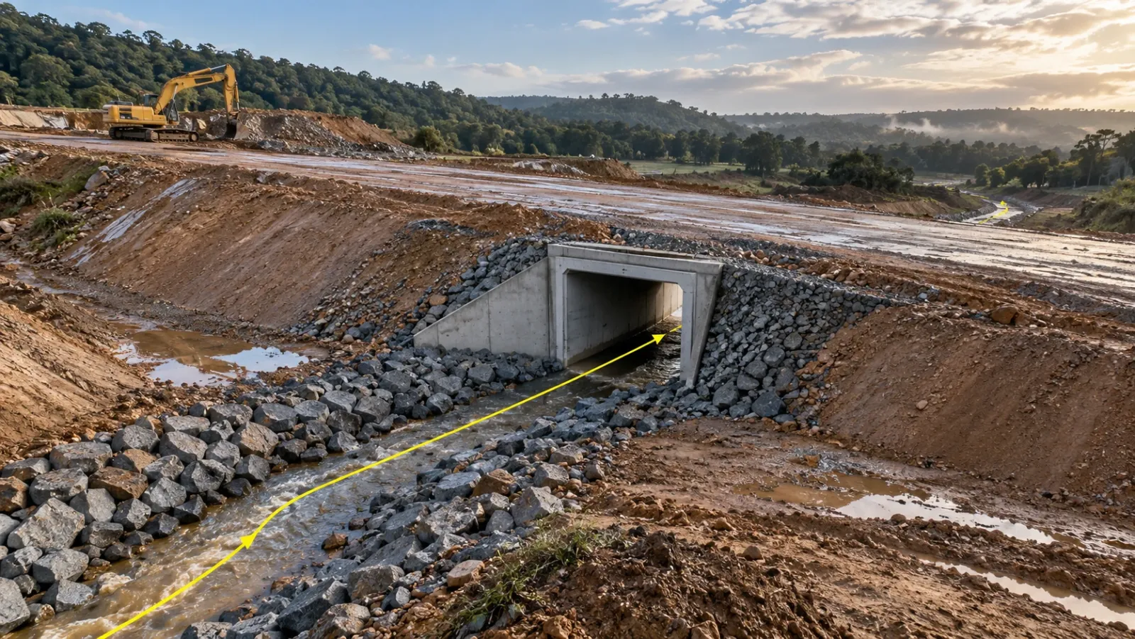
Executive Summary
- The Question: What does a civil engineer actually do with drone data, and at which stage of a project does it earn its place?
- The Answer: Drone flights give the engineer a measured terrain model before design, a check on drainage and earthwork during construction, a condition record of structures and a dated as-built surface at handover. It works when the data is specified like any other survey: datum, control, accuracy and formats agreed first.
- The YelloSKYE Angle: Survey IQ turns controlled drone flights into terrain models, contours, volumes and flow analysis in engineering formats, and stores each flight in the DEX platform, so every stage can be measured against the one before.
Civil engineers use drones to collect measured data about the ground and the works: terrain models for design, catchment and flow information for drainage, quantities for earthworks, imagery of structures and a dated record of what was built. The aircraft matters less than the datasets processed from it, and those datasets are only as useful as the survey specification behind them.
This guide is written from the engineer's side of the table. It sets out which drone outputs feed which engineering task, what accuracy each task needs, and where conventional survey still does the job better. YelloSKYE's Survey IQ provides this data for land and infrastructure projects. If you want the wider picture of drones across building sites, see drones in construction; for the full range of survey types and instruments, see the construction surveying guide.
The datasets a civil engineer works with
A single mapping flight, processed properly, produces several products. Each has a different job in the design office.
- Orthomosaic. A scaled, georeferenced image of the site. Engineers use it as the background for layouts, to trace existing features and to check alignments against what is really on the ground.
- Digital surface model (DSM). Heights of the top of everything visible: trees, buildings, plant. Useful for clearance checks and line-of-sight studies, but not for design levels.
- Digital terrain model (DTM). The bare-earth surface, with vegetation and structures filtered out. This is the surface that grading, drainage and volume calculations should use.
- Contours and breaklines. Contours give a familiar view of the terrain; breaklines along kerbs, ditch inverts and bank tops keep the surface sharp where the ground changes abruptly.
- Point cloud. The dense set of measured points behind the surfaces, which lets an engineer cut sections anywhere or reprocess the ground model later.
YelloSKYE delivers these as GeoTIFF, DXF, DWG, LAS or PDF, so they open in the CAD and GIS tools the design team already uses. A deeper look at how the terrain products are produced is in our guide to the drone topographic survey.
Drone tasks by project stage
The table below follows a typical civil scheme, whether a road, a drainage network, an industrial platform or a utility corridor. The accuracy column is the one engineers should argue about at scoping, because it decides how the flight is controlled.
| Stage | Engineering task | Drone dataset | Accuracy that matters | Checked by |
|---|---|---|---|---|
| Option appraisal | Compare routes or site layouts, estimate earthwork order of magnitude | Orthomosaic, DTM, slope map | Relative heights across the site | Design lead |
| Preliminary design | Fix alignment, platform levels, catchment boundaries | DTM, contours, flow analysis | Absolute heights on project datum | Highway or drainage engineer |
| Detailed design | Grading, cut and fill balance, culvert and outfall levels | DTM with breaklines, sections | Heights at inverts, bank tops and tie-ins | Design checker, surveyor |
| Enabling works | Record pre-start condition, clearance extents, temporary drainage | Orthomosaic, DSM | Position of features and boundaries | Site engineer |
| Earthworks | Measure progress, verify quantities, keep material balanced on site | Repeat DTMs against the design surface | Volume difference between surveys | Quantity surveyor, owner's engineer |
| Structures and drainage | Record culverts, walls, abutments and slopes before they are buried or backfilled | High-resolution imagery, point cloud | Visual detail and position | Resident engineer |
| Handover | Deliver as-built surfaces and the project image archive | Final DTM, orthomosaic, dated flights | Agreement with design within tolerance | Owner, asset manager |
| Operation | Watch slopes, channels and structures for change | Repeat captures on a fixed schedule | Change between captures | Maintenance engineer |
Two things stand out. The same terrain model carries through most of the stages, so the first flight is worth controlling well. And the later stages depend on comparison: a single survey is a picture, a series of surveys on the same datum is a measurement of change.
Terrain models for design
Most civil design starts with the existing ground surface. An alignment is a line through it, a platform is a level cut into it and a drainage network follows its falls. A drone DTM gives the designer a continuous surface across the whole site, rather than a grid of spot levels with the gaps filled by interpolation.
Getting the surface right
The value of the DTM depends on three decisions made before anyone flies:
- Coordinate system and vertical datum. The survey must sit on the project grid and the height datum the design uses. A model on the wrong datum is precise and wrong.
- Ground control and check points. Control ties the model to that datum; separate check points, not used in processing, prove the result. YelloSKYE pairs RTK-GNSS aircraft with ground control points, giving accuracy better than 5 cm in both plan and height. See our guide to ground control points for how many and where.
- Ground cover. Photogrammetry sees the top of grass and scrub, not the soil beneath. Where vegetation is dense, plan for LiDAR or ground survey of the affected areas, and ask for the DTM classification to be checked there.
Testing the design against the ground
Once the CAD layout sits on the drone surface, mismatches show up quickly: a road profile that daylights in the wrong place, a platform that needs far more fill than assumed, a boundary that clips a neighbour's structure. In our terrain-based design validation work, Survey IQ aligns the CAD layout to the drone DEM/DTM so that level mismatches, encroachments and alignment offsets are dealt with at the planning stage, before they become site instructions.
Drainage and catchments
Water is where small terrain errors become expensive. A low point missed by a coarse survey turns into a ponding problem on a finished road, and a catchment boundary drawn in the wrong place undersizes a culvert.
A drone DTM helps in three ways:
- Catchment definition. Flow direction and accumulation can be calculated across the whole surface, giving catchment areas and flow paths as inputs to the hydraulic design.
- Low points and outfalls. Depressions, existing ditches and outfall levels are measured rather than assumed, so the network ties into the ground at levels that work.
- Surface type. Classifying the orthomosaic into hard surfaces, vegetation, water and open ground supports the runoff assumptions behind the design.
YelloSKYE's flood risk and drainage survey combines these: the DEM and DTM, a water flow simulation run on the terrain model and land use and land cover classification, all from one drone mobilisation. A practical tip for the construction stage: fly soon after heavy rain. Standing water in the orthomosaic shows exactly where temporary drainage is failing and where finished levels need checking.
Earthworks
Earthworks are usually the largest quantity on a civil scheme and the one most often disputed. The engineering questions are simple to state: how much has been cut, how much has been placed, and does the site still balance?
Repeat drone surveys answer them by comparing each new DTM with the original ground and with the design surface. The difference gives cut and fill by area, and a colour map shows where the ground is above or below design. YelloSKYE's volumetric measurements are within 1 to 3% of traditional survey methods. In our earthwork volumetric analytics use case, a highway team replaced a two-week manual survey cycle with drone surveys processed in a few hours (5× faster); billing disputes ended, and the site team used the numbers to keep material balanced on site and pay for less external hauling.
For engineers, the less obvious benefit is the mass haul picture. Knowing week by week where surplus material sits, and where fill is still needed, lets the earthworks plan adjust before trucks start leaving site with material that will later be bought back. The method for the volume calculation itself is covered in the cut and fill volumes guide.
Structures, slopes and buried work
Civil schemes contain many elements that are hard to reach or soon covered: culvert barrels, headwalls, retaining wall faces, bridge bearings, embankment slopes and drainage runs that are backfilled within days.
Recording before it disappears
Close-range drone imagery taken at each key point shows, with a date, what went in and exactly where. A culvert photographed and measured before it is buried can be checked against the drawings years later without excavation. This is cheap at the time and impossible to recreate afterwards.
Condition of existing structures
On schemes that tie into existing bridges, walls or embankments, a drone survey records their condition before work starts, which protects both the owner and the contractor if damage is later alleged. For routine inspection of bridges themselves, see our guide to drone bridge inspection.
Where drones stop
Monitoring of settlement or wall movement at millimetre level belongs to precise levelling, total stations or instruments fixed to the structure. Drone surveys show change at the centimetre scale across a whole slope, which is useful for spotting where to look, but they are not a substitute for a monitoring regime with defined trigger levels.
Linear schemes
Roads, railways, pipelines and channels add a twist: the site is long and narrow, and everything is referenced by chainage. Drone corridor mapping follows the alignment with terrain-following flights and produces continuous orthomosaics and terrain models along it. In our linear corridor mapping use case, Survey IQ and Construct IQ map progress to section milestones by chainage on the DEX platform, so planned alignment and built work can be compared section by section. The drone corridor mapping guide covers flight planning for these schemes.
Records and handover
At the end of a civil project the owner inherits an asset that will be maintained for decades. Most of its critical details, such as invert levels, buried pipe routes and the true finished ground, are hard to see once the scheme is open.
A dated series of drone surveys gives the owner:
- the final as-built surface, comparable with the design surface;
- the condition of every structure and slope at handover;
- images and models of buried elements captured before they were covered;
- a baseline for future inspections, so later change can be measured rather than described.
Keeping this in one platform, rather than as files on a contractor's drive, is what makes it usable after the project team has moved on.
Where conventional survey still leads
Drone data does not replace the survey team. It changes where their time goes.
| Task | Better method | Why |
|---|---|---|
| Legal boundaries | Licensed land surveyor | Boundary definition is a legal matter in most countries |
| Setting out structures | Total station, GNSS rover | Millimetre positioning of individual points |
| Settlement and deformation monitoring | Precise levelling, monitoring prisms | Repeatable millimetre-level change |
| Ground under dense vegetation | LiDAR or ground survey | Photogrammetry cannot see the soil |
| Under bridge decks and in tunnels | Laser scanning, ground survey | Weak satellite signal and limited flight space |
| Underground utilities | Utility detection survey | Nothing below the surface is visible from the air |
Flying rules also vary. Each country's aviation authority (the FAA in the US, say, or the GCAA in the UAE) decides what is allowed near live roads, railways, people or airports, and asset owners often add conditions of their own. Build approvals into the programme rather than assuming a flight can happen tomorrow.
Specifying drone data for an engineering scope
Treat a drone survey like any other survey deliverable and write it into the scope. A short specification avoids most of the problems engineers meet with drone data.
| Item | What to state |
|---|---|
| Coordinate system and datum | Project grid and vertical datum, with the control points to tie into |
| Accuracy and proof | Required accuracy, number of independent check points and the accuracy report format |
| Resolution | Ground sampling distance suited to the smallest feature you need to see |
| Surface classification | DTM filtered for vegetation and structures, with breaklines where levels change sharply |
| Deliverables and formats | Orthomosaic as GeoTIFF, surfaces and contours as DXF or DWG, point cloud as LAS |
| Frequency | Fixed capture dates tied to design milestones and earthwork measurement periods |
| Data ownership and storage | Who holds the archive, and for how long after handover |
Checklist for using drones on your next civil scheme
- Decide which stage decisions the drone data will support, and list them.
- Fix the project grid, vertical datum and control network before the first flight.
- Ask for independent check points and an accuracy report with every survey.
- Base design and volumes on the DTM, not the DSM.
- Fly the baseline before any clearance or enabling works.
- Tie earthwork surveys to measurement and payment periods.
- Photograph and measure culverts, pipes and structures before they are backfilled.
- Check flight permissions with the aviation authority and the asset owner early.
- Keep every survey in one dated archive that the owner can use after handover.
Frequently asked questions
How are drones used in civil engineering?
Civil engineers use drone data as a measured record of the ground and the works. Before design it provides terrain models, contours and drainage analysis; during construction it measures earthwork quantities and records structures; at handover it gives the owner a dated as-built surface and image archive. The drone is the capture tool; the value is in the engineering datasets processed from its flights.
Is drone survey data accurate enough for civil engineering design?
For terrain modelling, grading, drainage and earthwork quantities, a controlled drone survey usually is. YelloSKYE flies RTK-GNSS drones with ground control points and achieves sub-5 cm horizontal and vertical accuracy, checked against independent points. Setting out, structural monitoring and legal boundaries still need conventional survey instruments and, for boundaries, a licensed surveyor.
What is the difference between a DSM and a DTM for civil design?
A digital surface model (DSM) records the top of everything the camera sees, including vegetation, vehicles and structures. A digital terrain model (DTM) removes those features to represent bare ground. Civil design, drainage analysis and earthwork volumes should be based on the DTM, with the DSM kept for checking clearances and visual context.
What file formats do civil engineers receive from a drone survey?
Orthomosaics normally come as GeoTIFF files for GIS and CAD backgrounds, terrain and contours as DXF or DWG for design software, and point clouds as LAS. Agree the coordinate system, vertical datum and formats before the flight so the data drops straight into the design model without conversion.
Do you need permission to fly a drone on a civil engineering project?
Usually, yes. Rules on pilot licensing, flying near roads, railways, people and airports, and flying beyond visual line of sight differ by country. The national aviation authority sets them (the US FAA, the UK CAA and the UAE GCAA are examples), and many asset owners also add their own permit-to-fly conditions on live roads and railways.