Drone Bridge Inspection: What It Finds, How It Is Flown and Where It Stops
By Kush Agarwal, President and CEO, YelloSKYE. Published .
Executive Summary
- The Question: What can a drone inspection tell you about a bridge, how is it flown beneath and around the deck, and how does it fit the inspections a bridge owner already has to carry out?
- The Answer: A drone records the visible condition of every reachable face of the structure, including soffits, bearings, joints and pier heads that normally need specialist access. It is the fastest way to see the whole bridge and to decide where an inspector must get hands on, but it does not replace that close examination or the inspector's judgement.
- The YelloSKYE Angle: Inspect IQ maps bridges with survey-grade capture, records load-bearing joints and surface cracking, and delivers each located finding in the DEX platform so maintenance can be scheduled before defects grow.
A drone bridge inspection uses a camera-carrying drone, flown around and beneath a structure, to photograph its deck, beams, piers, bearings and joints at close range and record where each defect sits. It finds most visible deterioration, such as cracking, spalling, corrosion staining, failed joint seals and displaced bearings, without putting an inspector on an under-bridge platform for the first look.
For bridge owners, road and rail operators and the engineers who inspect for them, the drone does not change who decides; it changes what they have in front of them when they decide. YelloSKYE's Inspect IQ treats a bridge as a set of elements to be recorded and compared over time, with attention on joints and load-bearing components. This guide covers what a drone picks up on a bridge, how flights under and around a deck work, what the deliverables look like, how drone capture fits periodic inspection regimes and where its limits are.
Why bridges are awkward to inspect
Most of a bridge's critical parts are where people cannot easily stand. The soffit hangs over a river, a railway or a live carriageway. Bearings sit in a narrow gap between beam and pier head. Expansion joints are cut into the running surface. Getting eyes close to them traditionally means under-bridge inspection units mounted on lorries, mobile elevating work platforms, boats, rope access or temporary scaffolding, usually with traffic management on the road above or below.
Each of those methods brings cost, possession time and risk to the inspection team and to road users. A drone does not remove the need for them, but it shortens the list of places they have to go.
What a drone picks up on a bridge
A drone records the surface condition of each element. The table groups the common findings by where they occur and what they usually point to.
| Element | What the imagery shows | What it may indicate | Usual follow-up |
|---|---|---|---|
| Deck soffit | Cracking, damp patches, white efflorescence, rust staining, patches of lost concrete | Water passing through the deck, corroding reinforcement | Hammer survey, cover and chloride testing |
| Beams and girders | Cracks near supports and mid-span, spalled edges, exposed bar, impact scars from high vehicles | Shear or flexural distress, corrosion, strike damage | Engineer assessment, crack measurement |
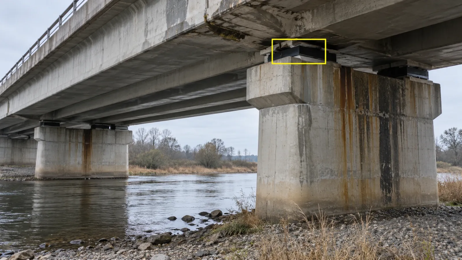
| Bearings | Tilted or walked-off bearing plates, squeezed elastomer, seized rollers, debris packed around them | Restrained movement, unexpected settlement | Close inspection, movement measurement |
| Expansion joints | Torn or missing seals, debris in the gap, broken nosings, water staining below | Leaking joint feeding deterioration underneath | Joint cleaning or replacement |
| Piers and abutments | Vertical or map cracking, spalling at the splash zone, vegetation in cracks, staining | Corrosion, alkali-silica reaction, poor drainage | Testing, monitoring between surveys |
| Steelwork | Coating breakdown, surface rust, pack rust between plates, missing or loose bolts | Section loss in progress, fatigue risk at details | Thickness gauging, close check of connections |
| Parapets and drainage | Damaged barriers, blocked gullies and outfalls, broken downpipes | Road safety risk, water being directed onto the structure | Repair, cleaning |
On the asset inspection page, YelloSKYE's AI models are described as trained to pick out cracks, spalling, corrosion and thermal anomalies, with each finding geotagged and given a category for a reviewer. On a bridge that matters because one survey can produce thousands of images, and the useful part is the short list of elements where something has changed. The inspector still reviews every flagged item and decides what it means.
Thermal imaging on concrete decks
Infrared thermography is an established way of finding delamination in concrete decks, because a separated layer heats and cools at a different rate from sound concrete when the sun warms the surface. It works only in the right conditions and on exposed decks without thick surfacing. The physics and timing are covered in our guide to drone thermal inspection; for a bridge, treat a thermal pattern as a prompt for a hammer or chain-drag survey, not as a measured area of damage.
Flying beneath and around the deck
The flying is the part that most separates bridge work from other inspections. A bridge is a cluttered, partly enclosed structure, often over water or traffic, and the drone has to work close to it.
Signal and positioning
Under a deck the drone loses much of its view of the sky, so satellite positioning weakens or drops out. Aircraft used for this work hold their position with vision or other onboard sensors, and pilots fly them with a deliberate, slow technique. Large steel members can upset a drone's compass, so the operator checks behaviour near the structure before committing to close passes.
Camera angles
A camera that only points down or forward cannot see a soffit properly. Under-deck work needs a gimbal that tilts upwards, or a drone built with an upward-facing camera, so that each bay between beams is photographed square-on. Bearings need oblique shots from both sides of the pier head, since a bearing plate can look normal from one angle and clearly displaced from another.
A sensible capture order
A typical sequence for a multi-span bridge:
- Deck surface. A mapping flight over the running surface for an orthomosaic, timed around traffic.
- Elevations. Passes along each fascia and parapet, square to the face.
- Soffit. Bay by bay beneath the deck, span by span, with the camera looking up.
- Piers and abutments. Vertical columns of images around each support, from the waterline or ground to the pier head.
- Bearings and joints. Close, slow detail shots at each support and joint line.
Keeping the order and stand-off distance the same each time is what makes the next survey comparable. YelloSKYE flies pre-programmed paths around structures wherever the site allows, so the views line up from one inspection to the next.
Permissions and site risks
Flights near bridges fall under the national aviation authority, whether that is the US FAA, the UK CAA, the UAE GCAA or another regulator, and often need the agreement of the road, rail or waterway operator as well. Practical risks include gusts funnelled along the river or under the deck, overhead electrified rail lines, birds nesting in the structure and drivers distracted by a drone. Flying over moving traffic is restricted in many places, which is why deck-top capture is often planned around a lane closure or flown from the verge.
What the deliverables look like
The output of a bridge survey should match how the bridge is managed: by span, by element and by inspection date.
| Deliverable | What it contains | Who uses it |
|---|---|---|
| Annotated image set | Close images for every element, with defects marked | Inspector, maintenance engineer |
| Defect register | Each finding with location, element reference, type and severity | Asset manager, maintenance planner |
| Deck orthomosaic | A true-to-scale map of the running surface | Surfacing and joint repair planning |
| 3D model or point cloud | Geometry of the structure, with imagery draped over it | Engineer, designer for repairs or widening |
| Comparison with earlier surveys | The same element seen on two dates | Anyone deciding whether a defect is growing |
YelloSKYE delivers findings as a defect database in which each entry carries marked-up images, its GPS position, a severity rating and a suggested remedy, and the whole set can be exported to PDF, Excel or BIM-linked formats. In the DEX platform, defects sit on the captured model of the asset, dashboards track open issues and severity across a portfolio of structures, and the historical comparison lets a reviewer move between capture dates to see when a crack first appeared. The deck orthomosaic is made the same way as any drone orthomosaic, just over a narrow strip instead of a site.
For long assets, bridge inspections often sit alongside corridor work. YelloSKYE's linear corridor mapping use case shows how aerial mapping is used along highways, pipelines and railways, and a bridge register can be built on that same continuous record.
How drone capture fits inspection cycles
Almost every bridge owner runs a tiered inspection regime, set by the owner or the national road or rail authority. Names and intervals differ between countries, but the structure is similar everywhere.
| Inspection type | Purpose | Where a drone helps | What still needs people at the structure |
|---|---|---|---|
| Routine or general | Regular visual check for obvious change and safety issues, commonly every year or two | Full visual record of hard-to-see faces without access equipment | Inspector's walk-over and condition rating |
| Principal or in-depth | Detailed close examination of every element at longer intervals | Pre-survey that shows where access and testing are needed | Close visual examination, testing, measurement |
| Special or event-driven | After a flood, vehicle strike, earthquake or a finding that needs watching | Fast record of the affected area, often the same day | Structural assessment of the damage |
| Underwater and scour | Condition of foundations below the waterline | Above-water view of the splash zone and bank erosion | Divers, sonar or other underwater methods |
Two points matter for planning. First, many regimes define how close an inspector must get to particular members, and some require examination within touching distance for critical elements. A drone image may or may not satisfy that wording, so confirm with the owner before planning a drone-only inspection. Second, the inspector remains responsible for the condition rating. The drone provides evidence; it does not assign a score.
Used well, drone capture changes the rhythm of the regime rather than its rules. Between principal inspections, a quick drone record can show whether a crack has grown, a joint has started leaking or a bearing has moved, so the next hands-on visit goes to the right span with the right equipment.
Where drone inspection stops
Being clear about limits keeps the record trustworthy.
- It cannot sound concrete. Hollow, delaminated areas often look intact; they are found by tapping or chain-dragging.
- It cannot measure section loss. Rust on a steel flange shows the problem exists, not how much steel is left. That needs thickness gauging.
- It cannot see below the waterline. Scour around foundations, a well-known cause of river bridge failures, needs underwater inspection.
- It cannot see inside closed sections. Box girders and hollow piers need internal access or specialist confined-space equipment.
- It cannot judge crack depth or activity. Width can be estimated from images; whether a crack is live needs measurement over time.
- It depends on conditions. Wind, rain, low light under wide decks and restricted airspace near airports all limit when you can fly.
The YelloSKYE facade inspection from a desk use case makes the same point about buildings: the map decides where people go and how urgently, but a person still has to touch the structure where touching is needed. The principle carries over directly to bridges, and our drone facade inspection guide covers the access trade-offs in more detail.
Building a repeatable bridge record
The first survey is a baseline. Its value grows with every repeat.
- Use the owner's element numbering. Findings referenced to span 3, pier 2, bearing B are far more useful than coordinates alone.
- Fly the same plan. Matching paths and distances produce matching images, which makes change visible.
- Track defects, not surveys. Each crack or leaking joint should keep one identity across inspections, with its history attached.
- Prioritise by consequence. A leaking joint above a bearing deserves faster action than cosmetic staining on a parapet.
- Record repairs. Close a finding only when a later capture or a repair photo shows the fixed condition.
YelloSKYE's automated asset inspection use case describes the same approach on towers and industrial structures: every finding tied to a position on a 3D model so maintenance moves from reacting to planning.
Checklist: planning a drone bridge inspection
- Confirm which inspection the survey supports: routine, principal, special or monitoring between cycles.
- Check the owner's rules on close examination and decide now which elements need hands-on access.
- Collect the bridge drawings and the element numbering used in previous reports.
- Agree airspace permissions and approvals from the road, rail or waterway operator.
- Plan traffic arrangements for deck-top capture and any work near live lanes.
- Choose an aircraft and camera suited to under-deck flight and upward views.
- Set the capture order and stand-off distances, and keep them for future surveys.
- Agree the deliverables: annotated images, defect register, deck map, 3D model.
- Book targeted access, testing and underwater inspection where the drone record says they are needed.
Frequently asked questions
Can drones be used for bridge inspections?
Yes. Drones are widely used to record the visual condition of bridge decks, beams, piers, bearings and joints, especially the parts that are hard to reach from the road or the ground. The qualified bridge inspector still rates the condition and signs the report, and some owners require certain members to be examined at close range by a person, so check what your bridge owner or road authority accepts.
Can a drone fly under a bridge deck?
It can, with the right aircraft and pilot. Satellite positioning is weak or lost beneath a deck, so under-deck work relies on drones that hold position using vision or other onboard sensors, often with a camera that can tilt upwards to look at the soffit. Steel structures can also disturb the compass, so operators test the site before flying close to the bridge.
Does a drone inspection replace a hands-on bridge inspection?
No. A drone records what can be seen, quickly and from angles that are otherwise hard to reach. It cannot tap concrete to find hollow areas, measure loss of steel thickness or check below the waterline. The usual pattern is drone survey first, then targeted hands-on access for the elements the record says need it.
Do you need to close a bridge for a drone inspection?
Often not fully. Work beneath the deck and around piers usually goes ahead with traffic still running, which is one reason owners use drones instead of under-bridge access vehicles. Flying over live traffic is restricted in many countries, so capturing the deck surface may need a short lane closure, a rolling traffic stop or a flight path along the verge.
What do you receive after a drone bridge inspection?
Typically a set of annotated images for each bridge element, a defect register tied to the bridge's own span and element numbering, and survey products such as an orthomosaic of the deck and a 3D model. With YelloSKYE these sit in the DEX platform, where findings can be compared with earlier surveys.