
with AI Site Intelligence.
Centralize every site update into a live digital twin. Make faster, zero-guesswork decisions.
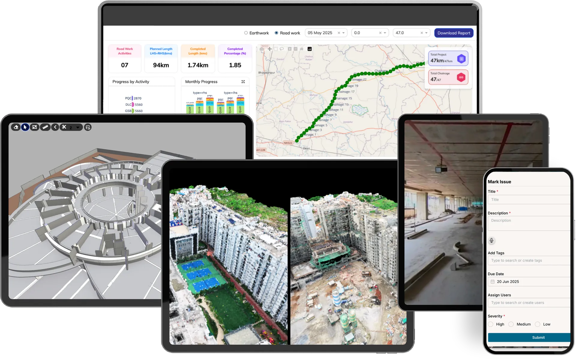
Ground Truth
to the Desktop.
Centralize every photo, scan, and BIM model into one unified intelligence layer.
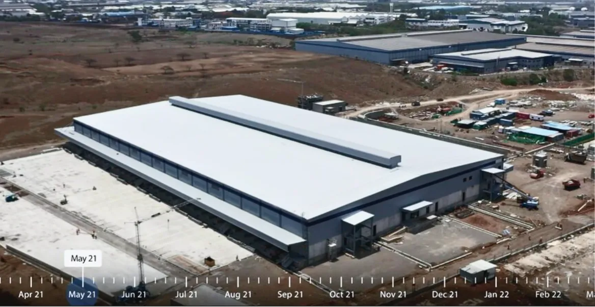
See every inch.
From anywhere.
Deploy autonomous robotics to capture high-res visuals and 3D maps, reducing manual site visits by up to 80%.
- Independent Updates
- Survey-Grade Capture
- Interactive Maps
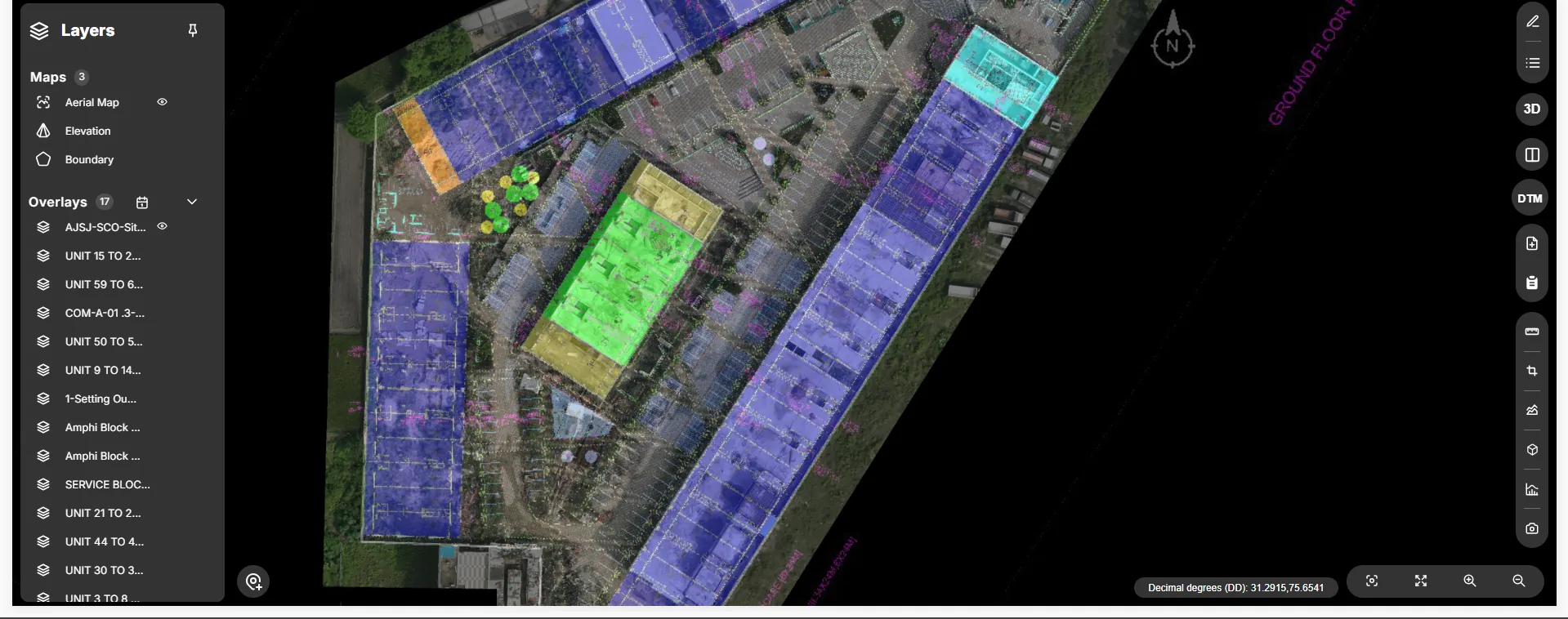
Clash Detected
Validate design
against reality.
Overlay CAD and BIM models on live site photos to identify mismatches and prevent rework before concrete is poured.
- Deviation Flagging
- ±5 mm Accuracy
- Revit/AutoCAD Export
Earthwork Volume
Protect margins
with data.
Verify every cubic meter. Automatically track earthwork volumes and consumption to ensure you only pay for work actually done.
- Independent Volume Checks
- Real-Time Cut/Fill Maps
- Automated Analytics
Boardroom-ready
transparency.
Eliminate disputes with an indisputable visual record. Centralize site reports, maps, and analytics in one unified dashboard.
- Historical Photo Logs
- Executive Reporting
- Portfolio Oversight
One platform.
Total clarity for every team.
Stop managing from
the rearview mirror.
DEX transforms fragmented site data into an autonomous visual record for faster, AI-driven decisions.
Compatible with your design tools.
Export data in formats your engineers already use. No need to change workflows—just add better data.
CAD Exports
DWG / DXF.
BIM Integration
RCP, LAS, LAZ.
GIS Platforms
GeoTIFF.
3D Mesh
OBJ & FBX.
From site reality to
decision clarity.
We don't just give you a login. We handle the capture, processing, and intelligence.
Reality Capture
Drones and sensors record on-site conditions.
AI Processing
Raw data is uploaded to DEX and aligned with models.
Insight Extraction
System flags deviations and updates progress.
Executive Action
Teams approve, bill, and resolve faster.
Command your projects with
AI-based Site Intelligence.
Centralize every site update into a live digital twin. Make faster, zero-guesswork decisions that keep your projects profitable and on schedule.
Ground Truth
to the Desktop.
Turn site data into confident action. One unified platform to see, validate, and accelerate your entire portfolio.
See.
Capture everything. Miss nothing.
Digitize your entire site to eliminate operational blind spots.
Drone Mapping & Terrain Models.
Stop relying on fragmented WhatsApp updates. Capture 50 acres instantly to generate high-definition orthomosaics and 3D terrain models.
Interior Verification.
Use 360° walkthroughs to verify MEP and finishing work.
24/7 Operations.
Fixed cameras provide an always-on log of workforce and material flow.
Validate.
Continuously verify physical site progress against your BIM models, master schedules, and BOQs.
Cut & Fill Volumes.
Contractor claims 5,000m³. DEX proves 4,250m³. Pay only for dirt moved.
Progress & Lag Analytics.
View planned vs. actual progress curves to spot lag times today.
BIM vs. As-Built Clash Detection.
Automatically overlay your 3D Navisworks/Revit models onto the physical site scan. Catch a misaligned column before the concrete cures.
Unite.
One source of truth for every team.
End the blame game and resolve issues 40% faster.
Geo-Tagged Issue Tracking.
Stop sending vague emails. Pinpoint defects directly on the 3D map, assign them to specific teams, and track resolution aging centrally.
Steel Alignment Error - C4
Water Pooling at Base
Central Data Vault.
All aerial maps, CAD overlays, and compliance docs secured in one cloud.
Enterprise Integrations.
Push ground-truth data directly into the tools your team already uses.
Act.
Execute with absolute certainty.
Authorize payments and report to investors with visual proof.
Executive KPIs.
Monitor schedule, quality, and margins across all projects.
Investor Reporting.
Generate high-fidelity time-lapse videos and flythroughs.
Audit-Ready RA Bill Approvals.
Don't rely on contractor estimates. Authorize milestone payments based on dated, visual proof and software-calculated volume analytics rather than subjective claims.
Stop tracking progress.
Start Commanding it.
Our autonomous agents process reality capture data into automated BOQs, clash reports, and precise schedules.
Progress Agent
Schedule IntelligenceAI turns drone flights into exact timeline data. Spot delays before they cascade—zero manual tracking required.
Billing Agent
Financial TruthVisual proof meets financial reality. Automatically cross-reference built progress against your BOQ to generate audit-ready bills.
Quality Agent
Automated InspectionCatch rework before concrete cures. AI scans site reality against BIM models to flag structural deviations instantly.
Content Agent
Boardroom-ReadyNever write a status email again. Auto-generate perfectly formatted stakeholder updates with hard visual evidence.
One platform.
Total clarity for every team.
Key Impact
Capital Protection
The Developer / Owner
Reduce interest costs through faster cycles and prevent expensive rework before concrete is poured.
Key Impact
Execution Speed
The Project Manager
Automate progress reporting and billing verification. Manage 3x more sites without increasing headcount.
Key Impact
Quality Assurance
The Architect / Design Lead
Instantly overlay CAD/BIM models on live site photos to identify deviations in seconds, not weeks.
Stop managing projects from the rearview mirror.
Deploy AI-automated site truth.
DEX leverages AI-powered reality capture to transform fragmented site data into an autonomous visual record—providing the indisputable proof needed for faster, AI-driven decisions.
The Traditional Way
Status Quo
- ✕
Fragmented Data
Photos stuck in WhatsApp, spreadsheets, and emails.
- ✕
Delayed Reporting
Reports arrive weeks late, making them outdated for live decisions.
- ✕
Frequent Disputes
Endless arguments over variations and subcontractor billing.
- ✕
Expensive Travel
High-level stakeholders wasting hours on routine site visits.
DEX Platform
Intelligent Workflow
- ✓
Unified Intelligence
Every photo, scan, and BIM model in one time-linked portal.
- ✓
Live Decision-Making
Verify site progress in real-time from any device, anywhere.
- ✓
Bulletproof Proof
Immutable visual records that eliminate disputes and bad billing.
- ✓
80% Remote Oversight
Free up your most expensive talent for high-value tasks.
Compatible with your
existing tools.
Export survey data in formats your engineers and architects already use. No need to change workflows—just add better data.
CAD Exports
Direct to DWG / DXF.
BIM Integration
Point clouds in RCP, LAS, LAZ.
GIS Platforms
GeoTIFF ortho-mosaics.
3D Mesh
OBJ & FBX visualization.
From site reality to
decision clarity.
We don't just give you a login. We handle the capture, the processing, and the intelligence.
Reality Capture
Our certified pilots or your on-site teams capture the site using drones, 360° cameras, or laser scanners.
AI Processing
Raw data is uploaded to DEX, where our proprietary AI engine aligns visuals with your CAD/BIM models.
Insight Extraction
The system automatically flags deviations, calculates volumes, and updates your progress dashboard.
Executive Action
Your team makes informed decisions, approves invoices, and resolves snags using a single digital truth.



