Drone Facade Inspection: What It Finds, How It Works and When You Still Need Rope Access
By Kush Agarwal, President and CEO, YelloSKYE. Published .
Executive Summary
- The Question: How does a drone facade inspection work on a high-rise or commercial building, what will it find, and can it take the place of rope access and scaffolding?
- The Answer: Working elevation by elevation on a planned grid, a drone records the whole envelope in high-resolution and, where useful, thermal imagery. The result is a located record of cracks, cladding and sealant faults, glazing problems and spalling that tells you where hands-on access is really needed, rather than a full replacement for it.
- The YelloSKYE Angle: Inspect IQ captures facades with RGB, thermal and LiDAR drone sensors and delivers each elevation in the DEX platform, where findings can be read against the elevation drawing, measured, compared between dates and marked before anyone books access.
A drone facade inspection is a survey of a building's external walls carried out by a drone that flies a planned pattern across each elevation, photographing the surface at close range and, where needed, recording thermal images as well. It finds most visible defects on high-rise and commercial buildings, such as cracks, failed sealant, damaged cladding and spalling concrete, in a fraction of the time it takes to rig access, and it records their exact position on the wall.
For building owners, facility managers and facade consultants, the main value is order. Instead of booking a cradle or a rope team to discover what is wrong, you look at the whole envelope first and send people only where the record says they are needed. This guide explains what a drone survey can and cannot detect, how one is planned and delivered, how it compares with rope access and scaffolding, how thermal imaging adds to it, and where close-up checks remain essential. It draws on how Inspect IQ, the YelloSKYE asset inspection solution, handles facade work.
What a drone survey of a facade actually is
A facade survey by drone is a condition record, not a structural assessment. The drone collects thousands of overlapping images of each elevation from a short distance, and software assembles them into a measurable map of each side of the building, a 3D model of the exterior and a register of defects with their positions. That record tells you where each defect is, how large it is and, once a second survey exists, whether it has changed.
It does not tell you why a defect exists or whether a wall is safe. That judgement belongs to a qualified facade engineer, who uses the record to decide what to inspect by hand.
Defects a drone facade inspection can find
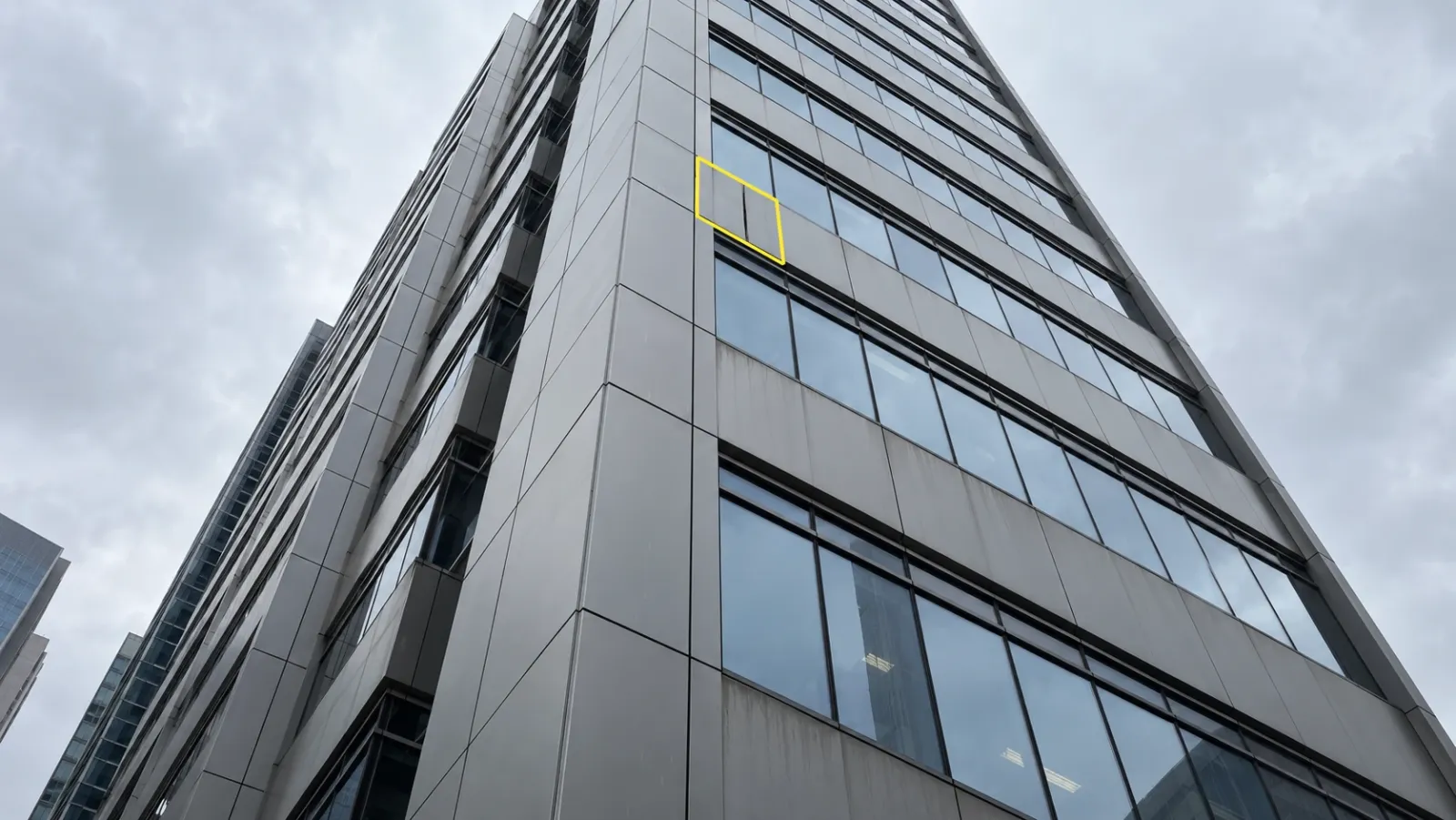
Most facade failures show themselves on the surface long before they become dangerous, and a camera held steadily a few metres from the wall sees them clearly. The table summarises what to expect.
| Defect | What it looks like in the imagery | Likely cause | How to confirm it |
|---|---|---|---|
| Cracking | Fine or open lines in render, masonry or concrete, often at corners of openings | Movement, shrinkage, corroding steel behind the surface | Measure width on site, monitor between surveys |
| Spalling | Broken or missing patches of concrete, sometimes with exposed bar and rust staining | Reinforcement corrosion, frost, poor cover | Hammer tap and cover meter at the wall |
| Cladding faults | Displaced, bowed, cracked or missing panels, visible corrosion on frames and brackets | Failed fixings, impact, thermal movement | Rope access check of fixings and brackets |
| Sealant and joint failure | Gaps, cracked or debonded sealant, missing gaskets at panel and window joints | Age, UV exposure, movement beyond joint capacity | Close-up inspection and adhesion test |
| Window seal and glazing problems | Perished gaskets, cracked panes, misted double-glazed units | Seal ageing, frame movement, impact | Internal check from the occupied side |
| Signs of water ingress | Dark staining, efflorescence, algae and moss below ledges and joints | Failed flashings, blocked drainage, open joints | Moisture readings, opening up |
| Loose or damaged elements | Shifted copings, damaged balustrades, slipped or broken features at parapet level | Corroded fixings, impact, weather | Hands-on check before anything else |
The YelloSKYE asset inspection page lists the same core targets for facades: exterior cracking, failing window seals and cladding defects. Imagery is analysed by AI models trained to identify cracks, spalling, corrosion and thermal anomalies, and each finding is geotagged and categorised for an engineer to review. The model speeds up the search across thousands of images; the engineer decides what each finding means.
What the camera cannot see
A surface photograph cannot hear a hollow sound or feel a loose fixing. Render that has lost its bond to the wall can look perfect. Anchors behind a rainscreen panel, steel corroding inside a column and water tracking inside a cavity are all invisible from outside, unless they have already produced a crack, a stain or a thermal pattern. Treat a clean drone survey as "no visible defects", not "no defects".
How a drone facade survey is planned and flown
A good survey is mostly decided before the drone leaves the ground.
Scope and resolution
Start with the smallest defect that matters. If the brief is to find hairline cracking in render, the camera has to resolve detail of a millimetre or two, which means flying closer or using a longer lens than you would for checking missing panels. Agree which elevations, roofs, soffits and balconies are in scope, and gather the elevation drawings so findings can be referenced to them later.
Permissions and site controls
Urban flights near tall buildings need clearance from the country's civil aviation regulator (the US FAA, UK CAA and UAE GCAA are typical examples) and often consent from surrounding landowners. On the ground, the operator sets out a controlled area below the flight, and building occupants are told when the drone will pass their windows. Privacy is a real concern on occupied buildings: plan the timing, notify tenants and handle images of interiors with care.
The flight pattern
Each elevation is flown in a regular grid, usually in vertical columns or horizontal passes, with the camera square to the wall and a consistent distance from it. Neighbouring images overlap heavily so that software can stitch them into one continuous elevation map and build a 3D model. Extra oblique passes cover the undersides of balconies, canopies and window heads, which a square-on image misses.
YelloSKYE flies automated, pre-programmed grids around the structure, which is what makes a second survey comparable with the first: the same path produces the same views. Tall buildings bring their own challenges. Satellite positioning can be weaker close to a high wall, and wind tends to strengthen with height and around corners, so the operator plans stand-off distances, wind limits and fallback procedures before flying.
Delivery
After processing, YelloSKYE presents each facade in DEX's Facade view. Every side of the building is a separate high-resolution map, selected by capture date. Elevation drawings can be laid over the map once they have been prepared and published for the building, so a finding can be read against the drawing grid. Measuring tools take lengths and areas, a comparison view places two capture dates side by side, and a 3D model is one click away where one exists for that date. Issues are marked directly on the facade, and the facade maps, outline, 3D model and drawings can be downloaded for consultants. The facade inspection from a desk use case follows this sequence on a hotel tower.
YelloSKYE reports come as structured defect databases with annotated imagery, GPS coordinates, severity ratings and remediation recommendations, exportable to PDF, Excel and BIM-linked formats.
Drones compared with rope access, scaffolding and cradles
Each access method suits a different job. The real question is which one to use for which step.
| Method | Set-up | Coverage of the whole envelope | Can touch and test | Disruption to occupants and street | Best used for |
|---|---|---|---|---|---|
| Drone survey | Short: permissions, ground controls, flight plan | Complete, including roofs and high parapets | No | Low; brief flight near windows | Whole-building screening, repeat condition records, triage |
| Rope access | Moderate: anchors, rigging, rescue plan | One drop at a time | Yes | Moderate; exclusion zones below each drop | Targeted close-up inspection, testing, small repairs |
| Building maintenance unit or cradle | Low if installed; otherwise a hired unit | Limited to where the unit can reach | Yes | Moderate | Glazing and sealant work on buildings with permanent access |
| Scaffolding | Long: design, erection, licences | Only the scaffolded area | Yes | High; pavement and window obstruction for weeks | Major repair and replacement programmes |
Drones and rope access work best in sequence. The drone survey is flown while the building stays occupied and operational and covers the whole envelope at once. Rope access is then aimed at the drops where the record shows defects, and scaffolding is kept for repair programmes that need a working platform anyway.
Safety is part of the case as well. Keeping inspectors on the ground during the first, wide survey reduces the time people spend working at height, which is why Inspect IQ keeps maintenance teams on the ground while the initial data is gathered.
Thermal imaging for envelope leaks
A thermal camera records surface temperature rather than visible light. On a facade, temperature differences reveal how heat and moisture are moving through the wall, which shows things a normal photograph cannot.
What thermal patterns can point to
- Moisture behind the surface. Wet materials hold and release heat differently from dry ones, so damp areas often read as cooler or warmer patches that do not match the building's construction.
- Missing or slumped insulation. Gaps show as warm areas on the outside of a heated building in cold weather.
- Air leakage. Warm air escaping at window frames, joints and service penetrations leaves streaks or plumes.
- Thermal bridges. Slab edges, balcony connections and brackets show as regular lines, which helps separate design features from defects.
YelloSKYE uses radiometric thermal sensors, which record a temperature for every pixel rather than only a coloured picture. Its asset inspection use case describes them identifying insulation health, HVAC performance and hidden moisture behind the facade. The same sensors and workflow are used to find faulty panels on solar sites, as described in our solar farm thermal inspection use case.
Getting conditions right
Thermal surveys are far more sensitive to timing than visual ones:
- There must be a meaningful temperature difference between inside and outside, so heated buildings are usually surveyed in cool weather, often early in the morning or after dark.
- The elevation should be out of direct sun for several hours beforehand, otherwise solar heating hides the patterns you are looking for.
- Surfaces should be dry and wind light, because rain and wind both even out surface temperatures.
- Glass and polished metal reflect infrared like a mirror. On curtain walls and metal cladding, the camera may be reading the sky or the next building, not the facade.
Read every thermal anomaly as a question, not an answer. A cool patch might be water in the insulation or simply a change of material behind the cladding, so cross-check it against the visual images, the drawings and, where the stakes are high, moisture readings before repairs are specified.
When close-up checks are still needed
Drone surveys reduce access work; they do not remove it. Plan for people at the wall when:
- Bond and soundness matter. Hollow render, delaminating concrete and loose tiles are found by tapping, not looking.
- Fixings carry safety risk. Cladding brackets, anchors and restraint ties hidden behind panels need direct inspection or testing.
- A joint has to be opened. Checking sealant adhesion, cavity drainage or fire barriers inside a facade means taking something apart.
- Rules require it. Some periodic facade inspection laws for tall buildings specify hands-on examination of part of each elevation by a qualified professional. Check what your local authority accepts before planning a drone-only survey.
- Something looks loose. Any element that might fall should be secured or checked in person straight away, not added to the next survey.
The YelloSKYE facade use case is direct about this: a facade map does not replace a qualified engineer, or the hands-on checks that loose areas, fixings and joints require. What it changes is the order of work, so the decision about where to look and how urgently is made before access is booked.
Making facade inspections repeatable
The first survey sets a baseline. The real return comes from the second and third, when change becomes visible. A few habits make that possible:
- Fly the same plan every time. Matching paths and distances give matching images, which makes the comparison view meaningful.
- Keep defect references stable. A crack logged at a position on the east elevation should keep its reference through every survey, so its history builds up in one place.
- Set frequency by risk. Older buildings, exposed coastal sites and facades with known problems need shorter intervals than a new, low-risk envelope. Add an extra survey after severe storms or nearby works.
- Close findings with evidence. Mark repairs as complete only when a later capture, or a photograph from the repair team, shows the fixed condition.
- Keep the whole history. A dated envelope record supports maintenance budgets, insurance renewals and compliance audits.
A facade elevation map is built on the same principle as an orthomosaic, turned through ninety degrees. For recording and closing findings on any inspection, see construction site inspections, and the automated asset inspection use case applies the same approach to towers and industrial structures.
Checklist: planning a drone facade inspection
- Define the purpose: routine condition record, pre-purchase review, investigation or monitoring a known problem.
- Decide the smallest defect that matters and the image resolution needed to see it.
- List the elevations, roofs and soffits in scope, and collect the elevation drawings.
- Check whether local rules require hands-on examination, and plan those drops now.
- Confirm airspace approvals, ground controls and tenant notices with the operator.
- Decide whether thermal imaging is needed and schedule it for suitable conditions.
- Agree the deliverables: elevation maps, 3D model, defect register and severity scale.
- Book rope access or cradle work only where the results say it is needed.
- Fix the flight plan and interval for the next survey.
Frequently asked questions
What can a drone facade inspection detect?
A drone with a high-resolution camera picks up visible defects such as cracks, spalling concrete, rust staining, displaced or damaged cladding panels, failed sealant joints, broken glazing and worn window seals. Adding a thermal camera can reveal patterns that suggest trapped moisture, missing insulation or air leakage. Anything that has to be felt, tapped or opened up still needs a person at the wall.
Is a drone facade inspection a replacement for rope access?
It replaces much of the looking, not the touching. A drone survey records the whole envelope quickly and shows where the problems are, so rope access or a cradle is booked only for the areas that need hands-on checks, testing or repair. Most owners use the two together: drone first, targeted access second.
How long does a drone facade survey take?
The flying is the short part. A single elevation of a mid-rise building can often be captured in one session, while permissions, site set-up, weather windows and any separate thermal flight add to the programme. Processing the images into elevation maps, a 3D model and a defect register takes longer than the flight itself.
Can thermal drones find water leaks in a building envelope?
They can point to likely leak areas. Wet materials and gaps in insulation change how heat moves through a wall, which shows up as a pattern on a thermal image when conditions are right. The pattern is a lead, not proof: it should be confirmed with moisture readings or an opening-up inspection before repairs are specified.
Do I need permission to fly a drone around a tall building?
Usually, yes. Urban flights close to buildings fall under your country's aviation regulator, for instance the US FAA, the UK CAA or the UAE GCAA, and the building owner, neighbours and occupants also need to be considered. A professional operator handles the airspace approvals, risk assessment and site controls as part of the job.