Drone Surveys in Construction: Deliverables, Accuracy and Where They Pay Off
By Kush Agarwal, President and CEO, YelloSKYE. Published .
Executive Summary
- The Question: What does a drone survey actually give a construction project, how accurate is it, and where does it earn its cost?
- The Answer: A drone survey turns overlapping aerial images into measurable maps, terrain models, point clouds and volumes. With proper ground control it reaches centimetre-level accuracy and covers a whole site in a single mobilisation, which makes it the most practical way to measure land, earthwork and progress repeatedly.
- The YelloSKYE Angle: Survey IQ delivers drone topography, volumetrics and drainage analysis for developers, EPCs and infrastructure teams, with every survey held on one timeline in the DEX platform.
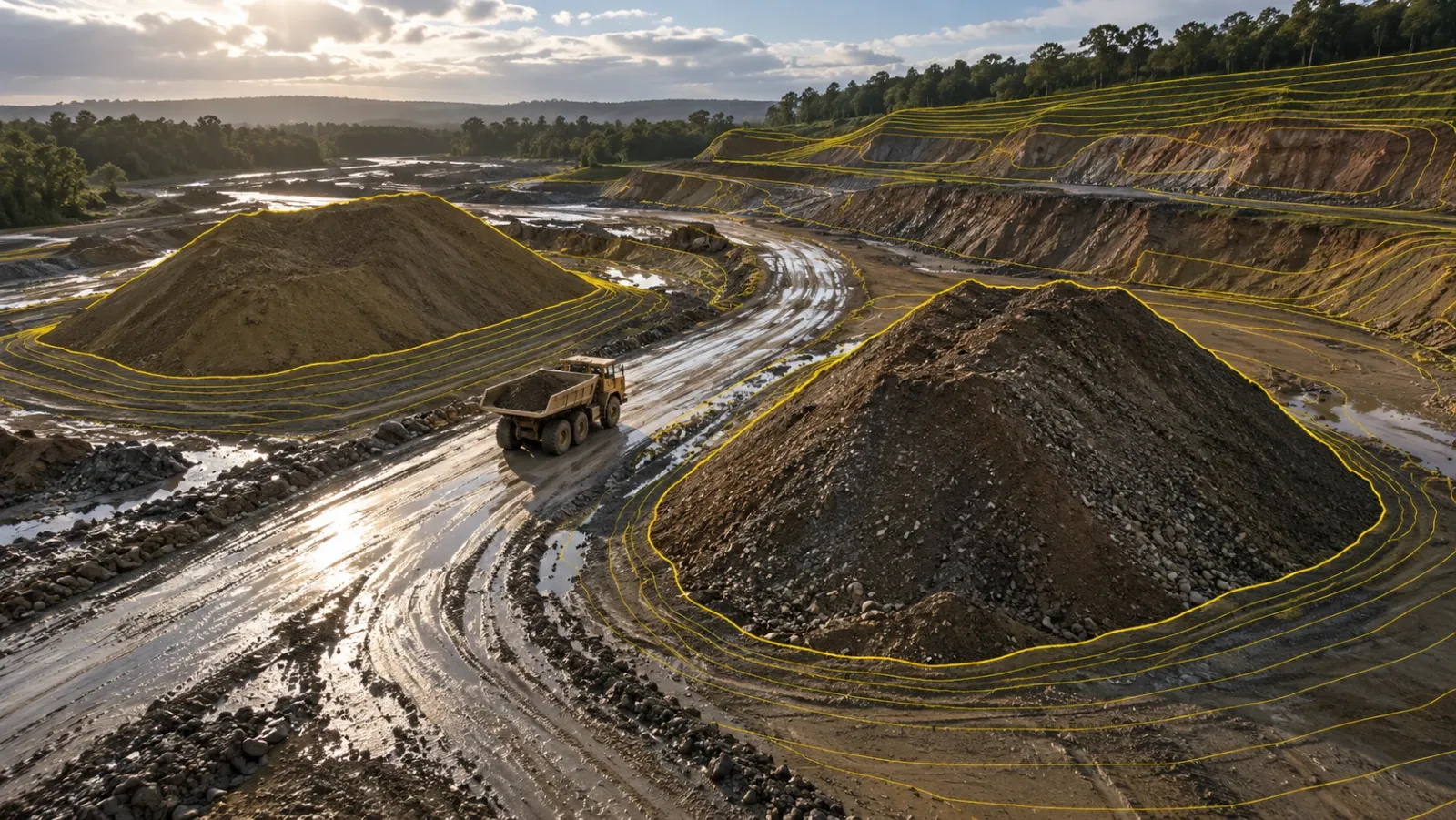
A drone survey in construction is a flight over a site that captures overlapping, geotagged images, which are processed into measurable outputs such as orthomosaic maps, elevation models, contours, point clouds and earthwork volumes. Done properly, it gives engineers survey-grade data for the entire site in a fraction of the time a ground crew needs, and it can be repeated on the same flight path every week or month.
For developers, EPC contractors and project management teams, that changes how land, earthwork and progress are measured. At YelloSKYE, drone surveys are delivered through Survey IQ, our land survey and terrain intelligence solution. This guide explains what a drone survey produces, how accuracy is achieved, how it compares with conventional methods and where it pays off across the project lifecycle.
What a drone survey produces
The aircraft is only the capture tool. The value sits in the processed deliverables, and each one answers a different question for a different team.
| Deliverable | What it is | Who uses it and why |
|---|---|---|
| Orthomosaic map | A single, true-to-scale aerial image stitched from hundreds of photos, corrected so distances and areas can be measured | Planning, site and PMO teams for layouts, logistics and visual records |
| Digital Surface Model (DSM) | Elevation of everything the camera sees, including trees, buildings and stockpiles | Clearance checks, stockpile measurement, obstruction studies |
| Digital Terrain Model (DTM) | Bare-earth elevation with vegetation and structures filtered out | Civil design, grading, drainage and cut/fill |
| Contour map | Lines of equal elevation derived from the terrain model | Design consultants and approval submissions |
| Point cloud | Millions of 3D points describing the site's geometry | Engineering analysis, BIM and detailed measurement |
| Volumetric report | Cut, fill and stockpile quantities calculated between surfaces or dates | Commercial teams, quantity surveyors, contractor billing |
| 3D mesh | A textured 3D model of the site | Stakeholder reviews and visual communication |
The difference between a DSM and a DTM matters more than most buyers expect. A surface model of a wooded plot shows the tree canopy; a terrain model shows the ground underneath. Designing drainage or estimating earthwork from the wrong one produces the wrong answer.
Survey IQ deliverables are exported in the formats engineering teams already work with: DWG and DXF for CAD, GeoTIFF orthomosaics for GIS, point clouds in LAS, LAZ and RCP, and 3D meshes in OBJ and FBX.
How a drone survey reaches survey-grade accuracy
A drone survey is only as good as its method. Four factors decide whether the output is a measurement or just a picture.
Positioning: RTK and PPK
Standard GPS on a drone can be off by metres. RTK (real-time kinematic) corrects each image's position during the flight using a base station or correction network. PPK (post-processed kinematic) applies the same correction after landing, which helps where a live correction signal is unreliable, as it often is on remote land parcels or long corridors.
Ground control and checkpoints
Ground control points are marked targets surveyed with DGPS or a total station. They tie the drone data to the project's coordinate system. Separate checkpoints, which are not used in processing, are what prove the accuracy afterwards. Ask any provider for a checkpoint report, not just a stated tolerance.
Ground sampling distance
Ground sampling distance (GSD) is the real-world size of one image pixel. Flying lower or using a better camera reduces GSD and increases detail, at the cost of more flight time and more images to process. The right GSD depends on the purpose: a land feasibility study and a stockpile audit need different settings.
Photogrammetry or LiDAR
Photogrammetry, using a standard RGB camera, is the workhorse for open construction sites, earthwork and progress records. It produces the orthomosaic that teams rely on day to day. LiDAR fires laser pulses and can reach the ground through gaps in vegetation, so it suits heavily wooded land or complex terrain where bare-earth accuracy is critical. It costs more and is not needed on most cleared sites.
With RTK or PPK positioning and proper control, Survey IQ terrain models deliver centimetre-level accuracy suited to feasibility studies, planning submissions and engineering design.
Drone survey vs conventional ground survey
Drone surveys do not make ground surveying obsolete. They change what each method is used for.
| Factor | DGPS or total station survey | Drone survey |
|---|---|---|
| Data density | Individual points chosen by the surveyor | Continuous coverage of the entire site |
| Coverage speed | Slow on large or uneven sites | A full site in a single mobilisation |
| Safety | Crews walk active haul roads, pits and slopes | Pilot stays at a safe launch point |
| Visual record | None beyond field notes | Orthomosaic and imagery of every square metre |
| Repeatability | Different points each visit | Same flight path, directly comparable outputs |
| Best for | Control points, setting out, legal boundaries, under-canopy spots | Topography, volumes, drainage, progress and change detection |
The practical pattern on most projects: ground instruments establish control and handle setting out, and drones capture the full site around them. On YelloSKYE's land acquisition and feasibility work, that combination has completed due diligence 5× faster than a conventional ground survey.
Where drone surveys pay off across the project lifecycle
Land acquisition and feasibility
Before a parcel is bought, developers need to know its true usable area, how its boundaries sit on the ground, how water moves across it and what preparing it will cost. A single drone mobilisation can provide boundary verification, terrain models, land-use classification and preliminary cut/fill estimates while the purchase decision is still open.
Design validation
Many layouts are still drawn over old topographic maps. Overlaying the CAD layout on a fresh drone terrain model shows level mismatches, encroachments and alignment errors before design lock-in, when fixing them is still a drawing change rather than a site change. Our terrain-based design validation use case walks through this workflow.
Drainage and flood risk
Storm run-off can decide where a project can build and what its drainage will cost. Water flow analysis on a drone terrain model traces how surface water moves, where it pools and which low points need attention. See drone survey for flood risk and drainage planning.
Earthwork, cut/fill and contractor billing
Earthwork is where drone surveys most often pay for themselves. Repeated surveys, compared against each other and against the design grading plan, turn monthly quantity claims into a calculation both sides can check. On one highway project, moving to drone-based volumetric analytics cut survey turnaround from two weeks to a few hours and ended monthly billing disputes over volumes moved. In mining, YelloSKYE's volumetric surveys report ±1% volumetric accuracy against around ±15% error for manual methods.
Stockpile and material tracking
Aggregate, soil and sand stockpiles are easy to overstate and hard to audit by eye. A surface model measures each pile's volume, and repeat flights show how inventory changes over time.
Linear and corridor projects
Highways, pipelines and rail corridors stretch across many kilometres and work fronts. Drone corridor mapping produces continuous, georeferenced orthomosaics and chainage-wise progress records, as described in our linear corridor mapping use case.
Construction progress and stakeholder reporting
Once structures rise, the same aerial capture becomes a progress record. Regular orthomosaics and milestone imagery let PMOs, lenders and leadership see the whole site without travelling to it. This is the territory of Construct IQ, YelloSKYE's construction monitoring solution, which uses drones alongside 360° cameras and fixed cameras to cover both the exterior and the interior of a project.
Planning a drone survey programme
A single flight is useful. A programme is where the value compounds. Five decisions shape it.
- Define the purpose of each flight. A design baseline, a monthly earthwork reconciliation and a stakeholder update need different resolution, coverage and deliverables.
- Set the cadence by phase. One detailed baseline for feasibility and design, then weekly, monthly or on-demand flights during earthwork and construction. Align flights with billing cycles and milestone reviews where possible.
- Fix the control network early. Permanent ground control set at the start keeps every later survey in the same coordinate system, so differences between dates reflect real change.
- Keep flight plans consistent. The same altitude, overlap and route each time make outputs directly comparable.
- Handle compliance properly. Drone operations are regulated nationally: Part 107 in the United States, the CAA in the United Kingdom and the GCAA in the UAE, for example. Most regimes cover aircraft registration, pilot certification and airspace permissions. Sites near airports, defence areas or other restricted zones need permissions in advance, and a professional provider should manage this for you.
Why survey data needs a shared home
The most common way drone survey value is lost is simple: the files arrive, a few people download them, and the rest of the project never sees them. Surveys from different months sit in different folders, and nobody can compare them quickly.
YelloSKYE delivers Survey IQ outputs into DEX, our digital execution platform. DEX keeps every survey on a single visual timeline, so teams can scrub between dates and see what changed and when. CAD and BIM layers can be overlaid on the captured site, and distances, areas and volumes can be measured remotely from a browser. Because drone data sits alongside 360° walkthroughs, fixed-camera feeds and laser scans in the same environment, the survey team, site engineers, commercial managers and leadership all work from one reference rather than separate exports.
How to evaluate a drone survey provider
Price per hectare tells you little on its own. These questions separate a survey partner from a flying service.
| Question to ask | Why it matters |
|---|---|
| Do you provide a checkpoint accuracy report? | Proves the stated accuracy on your site rather than in a brochure |
| How is ground control established? | Determines whether outputs align with your design coordinates |
| Can you deliver both DSM and DTM? | Bare-earth terrain is essential for design, drainage and cut/fill |
| Which file formats do you deliver? | Outputs must open in your CAD, GIS and BIM tools without conversion work |
| Is engineering analysis included? | Volumes, drainage and design comparison need civil and geospatial expertise, not just processing |
| How are repeat surveys compared? | Change detection and billing depend on consistent baselines and a shared timeline |
| Who handles aviation compliance and permits? | Avoids delays and liability on restricted or sensitive sites |
| Can the same partner cover other capture methods? | 360°, fixed-camera and laser scan data become more useful alongside aerial surveys |
The bottom line
A drone survey is a measuring instrument, not a photography exercise. Used with proper control, consistent flight plans and engineering analysis, it gives construction teams verified terrain, quantities and progress for the whole site, repeatedly, without putting crews on haul roads or slopes. The projects that benefit most are those that plan surveys around decisions, from the purchase of land through earthwork billing to milestone reviews, and keep every survey in one place where the whole team can use it.
Frequently asked questions
How accurate is a drone survey for construction?
With RTK or PPK positioning and well-placed ground control points, a photogrammetry drone survey delivers centimetre-level accuracy, which is enough for topography, earthwork volumes, design validation and progress records. Accuracy depends on flight height, image overlap, control and processing, so ask your provider for a checkpoint accuracy report with every survey.
Can a drone survey replace a DGPS or total station survey?
For mapping large areas, terrain models and volumes, a drone survey is usually faster and captures far more detail than point-by-point ground work. Ground instruments are still the right tool for setting out, legal boundary work and spots hidden under dense canopy. Most projects use ground survey to establish control and drones to capture the whole site.
Do you need permission to fly a survey drone?
In almost every country, yes. Survey flights fall under the national aviation authority, such as the FAA in the United States, the CAA in the United Kingdom or the GCAA in the UAE. A professional survey provider should handle registration, remote pilot certification and any airspace permissions before the flight.
Can drone survey data be used in AutoCAD, Civil 3D or GIS software?
Yes. Survey IQ outputs are delivered in standard formats: DWG and DXF for CAD, GeoTIFF orthomosaics for GIS, point clouds in LAS, LAZ and RCP, and 3D meshes in OBJ and FBX. Your design and planning teams can work with the data in the tools they already use.
How often should a construction site be surveyed by drone?
It depends on the phase. Feasibility and design usually need one detailed baseline survey, while earthwork and active construction benefit from weekly or monthly flights so quantities and progress can be compared between dates. Many projects add on-demand flights before billing cycles or milestone reviews.