Drone Survey Glossary: Reality Capture Terms Explained in Plain English
By Kush Agarwal, President and CEO, YelloSKYE. Published .
Executive Summary
- The Question: What do the terms in a drone survey proposal, flight plan or accuracy report actually mean?
- The Answer: Most of the vocabulary falls into six groups: flying, positioning, capture, processing, outputs and accuracy. Knowing a few dozen terms is enough to read a survey scope, ask the right questions and spot a weak deliverable.
- The YelloSKYE Angle: Survey IQ deliverables are described in this vocabulary, so a team that knows it can check what was flown, how it was controlled and what each output can be trusted for.
This drone survey glossary explains the words that come up when a site is mapped from the air and turned into measurable data. Each entry gives a plain definition and a note on why it matters. Terms are grouped by theme, because most only make sense next to their neighbours.
It is written for project managers, developers, engineers and owners who receive drone surveys rather than fly them. If you are commissioning a topographic survey through YelloSKYE's Survey IQ, this is the language the scope, the processing report and the deliverables will use. Terms within each theme run from A to Z.
Terms people most often confuse
Before the full list, these pairs cause most of the misunderstandings in survey scopes and reports.
| Often confused | The difference in one line | Why it matters |
|---|---|---|
| GSD vs accuracy | GSD is pixel size; accuracy is how close positions are to the truth | A sharp map can still be in the wrong place |
| DSM vs DTM | DSM includes objects on top; DTM is bare ground | Volumes and drainage need the right surface |
| Control point vs check point | Control is used to fix the model; check points only test it | Only check points give an honest accuracy figure |
| RTK vs PPK | Same correction, applied live or after the flight | Affects risk of gaps, not the final quality ceiling |
| Relative vs absolute accuracy | Internal consistency vs position on real-world coordinates | Design overlays need absolute accuracy |
| Orthomosaic vs aerial photo | Corrected to one scale vs perspective view | Only one of them can be measured |
| Photogrammetry vs LiDAR | Geometry from matched photos vs from laser ranging | Vegetation and budget usually decide |
Flight and aircraft
AGL (above ground level): Height measured from the ground directly below the drone, not from sea level or the take-off point. Why it matters: resolution depends on height above the ground being photographed, so AGL is the height that counts in a survey.
BVLOS (beyond visual line of sight): Flying where the pilot cannot see the aircraft with their own eyes. Why it matters: it allows long corridors and remote sites to be covered from one place, but it needs specific approval in most countries.
Fixed-wing and VTOL: Aircraft with wings rather than rotors; VTOL types take off vertically and then fly on their wings. Why it matters: they cover large areas and long routes efficiently, where a multirotor would need many battery changes.
Flight plan (mission): The saved set of lines, heights, speeds and camera triggers the drone flies automatically. Why it matters: reusing the same plan is what makes repeat surveys comparable. Our guide to drone mapping flight planning covers how one is built.
Gimbal: The motorised mount that holds the camera steady and points it. Why it matters: a stable, correctly angled camera gives sharp, consistent photos for processing.
National aviation authority: The government body that regulates drone flight in a country, such as the GCAA in the UAE, the FAA in the US or the CAA in the UK. Why it matters: its rules on certification, height, airspace and flying near people apply to every survey flight.
Remote ID: A broadcast that identifies a drone and its position to authorities and the public while it flies. Why it matters: where it is required, flying without it is not compliant, regardless of the survey's purpose.
Return to home (RTH): An automatic flight back to the launch point when the battery runs low or the link drops. Why it matters: its return height must clear the tallest obstacle on site, such as a crane.
Terrain following: Varying the aircraft's altitude so it stays a fixed distance above sloping ground. Why it matters: without it, resolution and overlap vary across hills and valleys.
VLOS (visual line of sight): Keeping the drone within the pilot's unaided view. Why it matters: it is the default condition for most commercial flights and limits how far a single take-off point can cover.
Positioning and control
Base station: A satellite receiver set up on a known point that measures positioning errors so they can be removed from the drone's data. Why it matters: if the base sits on a badly known point, every coordinate in the survey shifts with it.
Check point: A surveyed target kept out of processing so it can serve as an independent test of the result. Why it matters: it is the only independent proof of the accuracy stated in a report.
Coordinate reference system (CRS): The defined grid and datum in which coordinates are expressed. Why it matters: the survey must use the same system as the design drawings, or overlays will not line up.
Direct georeferencing: Placing the map on real coordinates using precise camera positions from the drone, with few or no ground targets. Why it matters: it saves time on site, but check points are still needed to confirm the result.
Geoid and height datum: The reference surface from which heights are measured, and the model that converts satellite heights to it. Why it matters: the wrong height datum puts every level in the survey out by the same amount.
GNSS: Global navigation satellite systems, the umbrella term for GPS and its counterparts such as Galileo, GLONASS and BeiDou. Why it matters: receivers that use several systems get more satellites and steadier positions.
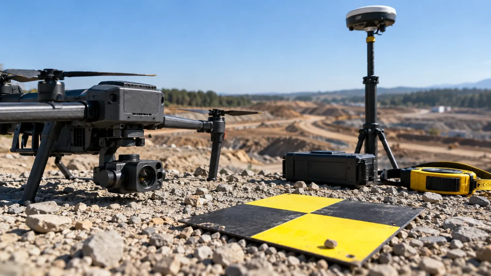
Ground control point (GCP): A marked target on the ground whose coordinates are measured precisely and used to fix the model in place. Why it matters: control is what ties a drone survey to the project's coordinates. See our full guide to ground control points.
PPK (post-processed kinematic): Correcting the drone's logged positions after the flight using base station data. Why it matters: it gives precise camera positions without relying on a live link. Our RTK vs PPK guide compares the two.
RTK (real-time kinematic): Correcting the drone's positions live during flight using a stream of corrections from a base or network. Why it matters: corrected positions are available at once, but a dropped link leaves gaps in accuracy.
Capture
Front overlap and side overlap: The share of each frame repeated in the next frame along a line (front) and in the frames of the adjacent line (side). Why it matters: too little overlap leaves gaps and weak areas in the model.
Global shutter and rolling shutter: A global shutter exposes the whole image at once; a rolling shutter reads it out line by line. Why it matters: a rolling shutter on a moving drone can skew the image slightly, which survey software must correct.
GSD (ground sample distance): The width of ground covered by one pixel. Why it matters: it sets the smallest feature you can see and measure, and it drives flight height and photo count.
LiDAR: A sensor that measures distance with laser pulses and records millions of 3D points. Why it matters: some pulses pass through gaps in vegetation, so it can map ground under canopy where photos cannot.
Multispectral and thermal: Cameras that record light outside the visible range, such as near-infrared or heat. Why it matters: they reveal vegetation health, moisture and temperature differences an ordinary camera misses.
Nadir: A photo taken with the camera pointing straight down. Why it matters: nadir grids are the standard for orthomosaics and terrain models.
Oblique imagery: Photos taken with the camera tilted from vertical. Why it matters: they capture walls, faces and steep slopes for realistic 3D models.
Processing
Bundle adjustment: The calculation that refines every camera position and the shape of the scene together until they agree. Why it matters: it is the core step that makes the model geometrically consistent.
Dense point cloud: Millions of 3D points generated after the cameras are solved, each with a colour. Why it matters: every surface, mesh and measurement downstream is built from it.
Orthorectification: Correcting a photo so every point appears as if seen from directly above at one scale. Why it matters: it turns a perspective photo into something you can measure on.
Photogrammetry: Measuring and reconstructing 3D shapes from overlapping photographs. Why it matters: it is the method behind most drone maps. Our drone photogrammetry guide explains it step by step.
Point classification: Labelling points as ground, vegetation, buildings and so on. Why it matters: it is how a bare-earth terrain model is separated from everything standing on it.
Reprojection error: The difference, in pixels, between where a point appears in a photo and where the solved model says it should appear. Why it matters: it shows internal fit, not real-world accuracy, so a low value alone proves little.
Structure from motion (SfM): The family of algorithms that recover camera positions and 3D structure from a set of photos. Why it matters: it is the engine inside modern photogrammetry software.
Tie points: Features recognised in more than one photo and used to link the photos together. Why it matters: few tie points on uniform ground is the usual cause of failed or patchy maps.
Outputs and measurement
Base surface: The reference surface a volume is measured against, such as original ground, a design level or a flat plane. Why it matters: the same stockpile gives different volumes against different bases, so it must be stated.
Breaklines: Lines that mark sharp changes in slope, such as kerbs, ditch edges and the top and toe of banks. Why it matters: without them, a terrain model rounds off edges that design depends on.
Contours: Lines joining points of equal height at a set interval. Why it matters: they are the familiar way engineers read terrain on a drawing.
Cut and fill: The volume of material to remove (cut) or add (fill) to reach a design level. Why it matters: it drives earthwork cost and is often the basis of contractor payment. YelloSKYE's automated earthwork volumetrics cut one EPC's survey turnaround to a few hours, where manual surveying had taken two weeks.
DEM, DSM and DTM: Elevation models. DEM is the general term; a DSM includes everything on the surface, a DTM is bare ground. Why it matters: each answers a different question, so ask for the one your task needs.
File formats: GeoTIFF for orthomosaics and elevation grids, LAS or LAZ for point clouds, DWG or DXF for CAD drawings, OBJ or FBX for meshes. Why it matters: agree formats early so the data opens in the tools your team already uses.
Orthomosaic: A stitched, orthorectified, georeferenced image of the whole site. Why it matters: it is the base map most people will use. Read more in what is an orthomosaic.
Water flow simulation: Modelling how surface water would run and collect across a terrain model. Why it matters: it shows flood-prone areas and drainage paths before layouts are fixed, which is the basis of YelloSKYE's drainage planning work.
Accuracy and quality
Absolute accuracy: How close positions on the map are to their true real-world coordinates. Why it matters: overlaying designs or boundaries needs it.
Accuracy report: The processing summary listing control and check point errors, coverage and settings. Why it matters: it is the evidence behind any accuracy claim, and it should be delivered with the data.
Relative accuracy: How well distances and shapes within the map match reality. Why it matters: areas, lengths and volumes depend on it even when absolute position matters less.
RMSE (root mean square error): A single figure summarising the errors at a set of check points. Why it matters: it is the usual way accuracy is stated, so ask which points it was calculated on.
Reality capture beyond the drone
360° capture: Spherical photos taken by walking a site with a camera. Why it matters: it records interiors and close-up work that aerial surveys cannot see.
Change detection: Comparing two dated surveys to find what moved, grew or disappeared. Why it matters: it turns repeat flights into progress and quantity evidence.
Reality capture: The umbrella term for recording physical conditions digitally, whether by drone, 360° camera, fixed camera or laser scanner. Why it matters: one platform holding all of them gives a single record of the site.
Scan to BIM: Turning point clouds of an existing structure into a BIM model. Why it matters: renovation and retrofit design can then start from measured conditions.
Using the glossary on a real survey
Survey IQ outputs, from the orthomosaic and contours to elevation models, point clouds, slope analysis and volume reports, are named in this vocabulary and published to the DEX platform, where the team measures distance, area and volume in a browser and lays CAD and BIM over the survey. On a pre-acquisition land survey, the buyer gets the orthomosaic, terrain models and drainage analysis at once; knowing what each shows is what lets them act on it.
Check that every survey proposal or report states:
- The target GSD and the flight height that achieves it.
- The control method: GCPs, RTK, PPK or a mix, and how many check points.
- The coordinate reference system and height datum, matching your drawings.
- Which elevation model is supplied (DSM, DTM or both) and how ground was classified.
- The base surface behind every volume figure.
- An accuracy report with check point RMSE, horizontal and vertical.
- File formats for each deliverable.
For the next step after the vocabulary, our guide to drone mapping software covers how to choose the tools that hold and measure these outputs.
Frequently asked questions
What is the difference between a DSM and a DTM?
A digital surface model (DSM) records the height of whatever the drone saw on top: buildings, trees, vehicles and stockpiles. A digital terrain model (DTM) removes those objects to show the bare ground. Use the DSM for heights of things on site and the DTM for grading, drainage and earthwork design.
What does GSD mean in drone surveying?
GSD stands for ground sample distance, the width of ground covered by one pixel in the image. A 2 cm GSD means each pixel shows a 2 cm square of ground. It sets the smallest detail you can see, but it is not the same as accuracy, which depends on positioning and control.
What is the difference between RTK and PPK?
Both correct the drone's satellite position using a nearby reference receiver. RTK applies the correction live during the flight over a radio or internet link, while PPK applies it afterwards using logged data. PPK is not affected by a dropped link during the flight; RTK gives corrected positions immediately.
What is a check point in a drone survey?
A check point is a surveyed target that is deliberately left out of processing. After the map is built, its measured position is compared with where it appears on the map. The differences give an honest measure of accuracy, because the software had no chance to fit the result to them.
Is photogrammetry the same as LiDAR?
No. Photogrammetry builds 3D geometry by matching features across overlapping photos, while LiDAR measures distances directly with laser pulses. LiDAR can record some ground beneath vegetation; photogrammetry gives true colour and is usually cheaper. Many projects use photogrammetry for open ground and LiDAR where canopy or detail demands it.