Hybrid Construction Surveys: Combining Drone, GNSS and Terrestrial Methods on One Project
By Kush Agarwal, President and CEO, YelloSKYE. Published .
Executive Summary
- The Question: How do you combine drones, GNSS, total stations and laser scanners on one project without ending up with datasets that disagree?
- The Answer: Give each method the part of the site it measures best, tie every one of them to a single control network and height datum, decide in advance which dataset wins where they overlap, and check the joins. The result is one record of the site rather than several partial ones.
- The YelloSKYE Angle: Survey IQ provides the aerial terrain layer, BIM IQ the scanned structures, and the DEX platform holds both on one timeline with the project's drawings and models.
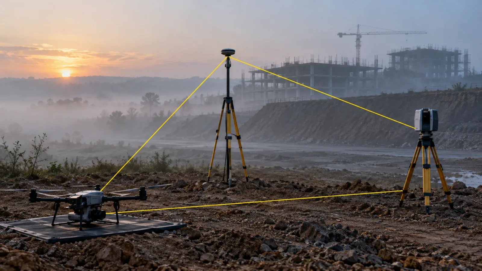
A hybrid construction survey is a survey that deliberately mixes methods, typically drone photogrammetry, GNSS, total stations and terrestrial laser scanning, so that each part of the site is measured by the instrument best suited to it, and then joins the results into one coordinated dataset. No single instrument reaches every corner of a real project, so most well-run sites are already hybrid. What separates a good hybrid survey from a patchwork is planning: a shared control network, an agreed coordinate system and rules for combining the data.
This guide covers how to split the work between methods, how to build the control that holds them together, how the datasets are merged and how to check the joins. If you want a refresher on what each instrument does, our construction surveying guide explains the methods one by one. At YelloSKYE, the aerial and terrain side of this work runs through Survey IQ.
Why one method leaves gaps
Every survey method has blind spots. A hybrid approach exists because those blind spots rarely overlap.
- Drones cover large open areas quickly and record the whole surface, but they cannot see the ground under dense canopy, inside buildings or beneath overhangs, and they see vertical faces poorly from straight overhead.
- GNSS receivers position points quickly anywhere with open sky, but lose accuracy close to tall structures, under trees and indoors, and they record only the points the surveyor chooses to measure.
- Total stations give the tightest short-range precision and work under cover, but they need line of sight and are slow over large areas.
- Terrestrial laser scanners capture dense 3D detail of structures and plant rooms from each setup, but each scan covers a limited range and needs registering to the others.
Put together, the strengths of one method fill the weaknesses of the next. The drone captures the open site, ground instruments pick up what the drone misses and fix the control, and the scanner records the detail on and inside structures.
The control network holds everything together
The most important part of a hybrid survey is the part nobody sees in the final model: the control. If each method sets up its own reference, the datasets will not line up, however carefully each one was captured.
Primary control
A small number of well-built, stable monuments are established first, usually by static GNSS observation tied to a national or project reference frame, with heights carried by precise levelling where vertical accuracy matters. These points are placed where construction traffic will not disturb them and are documented with photos, descriptions and coordinates.
Secondary control
From the primary network, the survey team sets denser working points close to where measurement will happen: total station setups, scanner target positions and drone ground control targets. Every one of them is measured from the primary control, not set independently.
One coordinate system and one height datum
All methods must report in the same horizontal coordinate system and the same vertical datum, in the same units. This is written down once, in a short survey specification that every contractor and provider receives. Most of the "the scan doesn't match the drone" problems on site trace back to someone working in a different system, or to GNSS ellipsoidal heights mixed with levelled heights on a local datum.
Splitting the work: who measures what
The table below is a starting point for dividing a typical land development or building project between methods. Adjust it to the site, but make the split explicit in the scope so that nothing is measured twice or not at all.
| Feature or deliverable | Lead method | Supporting method | Reason |
|---|---|---|---|
| Primary and secondary control | Static GNSS, total station, levelling | None | Everything else depends on it |
| Open terrain and earthworks | Drone photogrammetry | GNSS spot heights as checks | Whole-surface coverage in one visit |
| Stockpiles and cut and fill | Drone photogrammetry | Ground checks on stable areas | Repeatable volumes between dates |
| Ground under dense vegetation | GNSS or total station | Drone LiDAR where justified | Photos see the canopy, not the soil |
| Hard detail: kerbs, edges, manholes | GNSS rover or total station | Drone orthomosaic for context | Defined points need direct measurement |
| Drainage inverts and pipe levels | Total station or level | None | Below ground and tight tolerances |
| Existing buildings and plant rooms | Terrestrial laser scanning | Drone imagery for roofs | Dense geometry of complex shapes |
| Facades and tall vertical faces | Terrestrial scanning or oblique drone flights | Total station checks | Straight-down imagery misses them |
| Legal boundaries | Licensed surveyor with ground instruments | Drone orthomosaic overlay for review | Legal weight requires formal survey |
| Setting out foundations and steel | Total station | None | Millimetre work at short range |
How the datasets come together
Once each method has done its part, the data has to be merged into deliverables the design and site teams can use. This is where hybrid surveys succeed or fail.
Aerial data
Drone imagery is processed with the ground control targets set from the shared network, and with independent checkpoints held back to test it. Our guide to drone image processing covers that chain in detail. The outputs are an orthomosaic, a surface model, a bare-earth terrain model and a point cloud, all already on project coordinates.
Ground survey points and breaklines
Points measured by GNSS or total station are added to the terrain model where the drone could not see the ground, such as under trees, or where the shape needs to be sharper than a gridded surface can show, such as the top and toe of a slope or the edge of a road. These lines, called breaklines, force the terrain model to follow real edges rather than smoothing across them.
Laser scans
Scans are registered to each other and then to the control network through targets whose coordinates were measured from the secondary control. Once registered, the scan point cloud sits in the same space as the drone point cloud, so a building measured from the ground lines up with the terrain around it.
When two datasets disagree
Overlaps are useful because they show whether the pieces fit. Agree the rules before anyone goes to site.
| Situation | Usual rule | What a mismatch suggests |
|---|---|---|
| Drone surface and GNSS spot heights on open ground | Keep the drone surface, use GNSS points as checks | A consistent offset points to control or datum, not terrain |
| Drone surface under canopy and ground points | Ground points replace the drone surface | The drone recorded the tops of the vegetation |
| Drone and scan clouds on the same structure | Scan detail wins on vertical faces, drone on roofs and surroundings | A shift between clouds means registration needs checking |
| Two dates of the same area | Compare only data on the same control and datum | Apparent change may only be misalignment |
Three common hybrid patterns
Land development parcel
A large greenfield parcel is mostly open ground, so the drone does the bulk of the topography while GNSS sets control, measures the boundary points a surveyor needs to confirm and fills any wooded areas. One drone mobilisation, tied to that control, gives the developer terrain, drainage paths and preliminary cut and fill before buying. Our drone land survey for site feasibility use case shows this approach completing due diligence 5× faster than a conventional ground survey.
Linear corridor
Roads, pipelines and transmission lines stretch across many kilometres and changing terrain. Control is set at intervals along the route by GNSS, the drone maps the corridor in long terrain-following flights, and ground crews concentrate on structures, crossings and drainage. Because every section is tied to the same control, the corridor reads as one continuous dataset rather than a string of separate surveys. See our linear corridor mapping use case for how that record is used to check right-of-way clearing and progress by chainage.
Brownfield site with existing buildings
When a project sits around or inside existing structures, terrestrial laser scanning records the buildings, the drone maps roofs and external ground, and the total station handles control and critical tie-in points. The scan becomes the base for an as-built model, as in our scan to BIM for renovation use case, while the aerial survey places that building correctly on the site.
Checking a hybrid survey
A single checkpoint report is not enough when several methods are involved. Each dataset needs its own evidence, and the joins need checking too.
- Control closure. The control network report should show how well the measurements fit together before anything is built on it.
- Checkpoints per method. Drone checkpoints across the mapped area, scan registration errors per target and total station closure on its traverses.
- Overlap comparison. Where two methods measured the same area, compare them and record the difference. Consistent small differences are normal; a systematic shift is a red flag.
- Lineage. Every final surface or model should record which method supplied which part, and when. That matters later when someone asks where a level came from.
Keeping the combined record in one place
A hybrid survey produces several file types from several teams: CAD drawings from the surveyor, rasters and point clouds from the drone provider and registered scans from the scanning team. If these are sent around separately, the benefit of combining them is lost.
YelloSKYE delivers the aerial layer through Survey IQ, with drone topographic surveys covering 50 to 200 hectares per day and outputs in DWG and DXF, GeoTIFF, LAS, LAZ and RCP, and OBJ and FBX. On the scanning side, BIM IQ takes scans from Leica, FARO, Trimble and Matterport equipment as well as drone point clouds, whether they arrive as E57, LAS, RCP or another common file type, and registers them to model coordinates for as-built modelling. Both land in the DEX platform, which keeps drone, 360°, fixed-camera and laser scan data on one timeline with the project's CAD and BIM models, so the survey, design and site teams look at the same combined record. For how scans and models are kept in step, see our guide to reality capture and BIM.
What to put in your hybrid survey scope
- Name one coordinate system, height datum and unit for every method, in writing.
- Commission the control network first, and make every provider work from it.
- Split the site by method using a table like the one above, so every area has a lead method.
- Set the overlap rules that decide which dataset takes priority where two meet.
- Ask for checkpoint and registration reports from every method, not just the drone.
- Protect and recheck control after heavy earthworks or when monuments are disturbed.
- Require lineage on every merged surface and model.
- Keep all survey data in one shared platform so the combined record stays combined.
Frequently asked questions
What is a hybrid survey in construction?
A hybrid survey uses more than one measurement method on the same project, such as drone photogrammetry for open ground, GNSS and total stations for control and hard detail, and laser scanning for structures. All of the data is tied to one control network, so the pieces can be merged into a single, consistent record of the site.
Can drone and ground survey data be combined in one model?
Yes, provided both were measured on the same coordinate system and height datum. Ground points and breaklines are usually added to the drone terrain model where the drone could not see the ground, and laser scans are registered to the same control targets so they line up with the aerial data.
Which survey method should take priority where two datasets overlap?
Set the rule before survey starts. Directly measured ground survey points usually take precedence for hard features such as kerbs, inverts and building corners, while the drone surface is preferred for continuous open ground. Wherever two methods overlap, compare them: a consistent difference points to a control or datum problem rather than a real change.
Do you still need a land surveyor if you use drones and scanners?
Yes. The control network, legal boundaries and precise setting out still need qualified surveyors with ground instruments. Drones and scanners extend how much of the site can be measured and how often, but they depend on that control to be correct.
Is a hybrid survey more expensive than a single method?
Not necessarily. Using the fastest suitable method for each part of the site often reduces field time compared with walking the whole site with one instrument. The added cost is in planning and in merging the datasets, which is small next to the cost of resurveying when one method alone leaves gaps.