Power Line Drone Inspection: Towers, Corridors and Substations
By Kush Agarwal, President and CEO, YelloSKYE. Published .
Executive Summary
- The Question: Which faults on an overhead line or in a substation can a drone really pick up, and how do those findings become a maintenance plan the network team will act on?
- The Answer: Drones record the condition of towers, insulators, fittings, conductors and the corridor around them, usually while the line stays energised. Close-up flights at each structure find component defects, corridor mapping measures vegetation and encroachment, and thermal capture under load picks out hot connections. The value comes from grading every finding and filing it to a tower, phase and component.
- The YelloSKYE Angle: Inspect IQ checks towers and corridors for cracked insulators, absent hardware and encroaching trees while the lines stay energised, then logs every defect with its position, severity and suggested fix in the DEX platform.
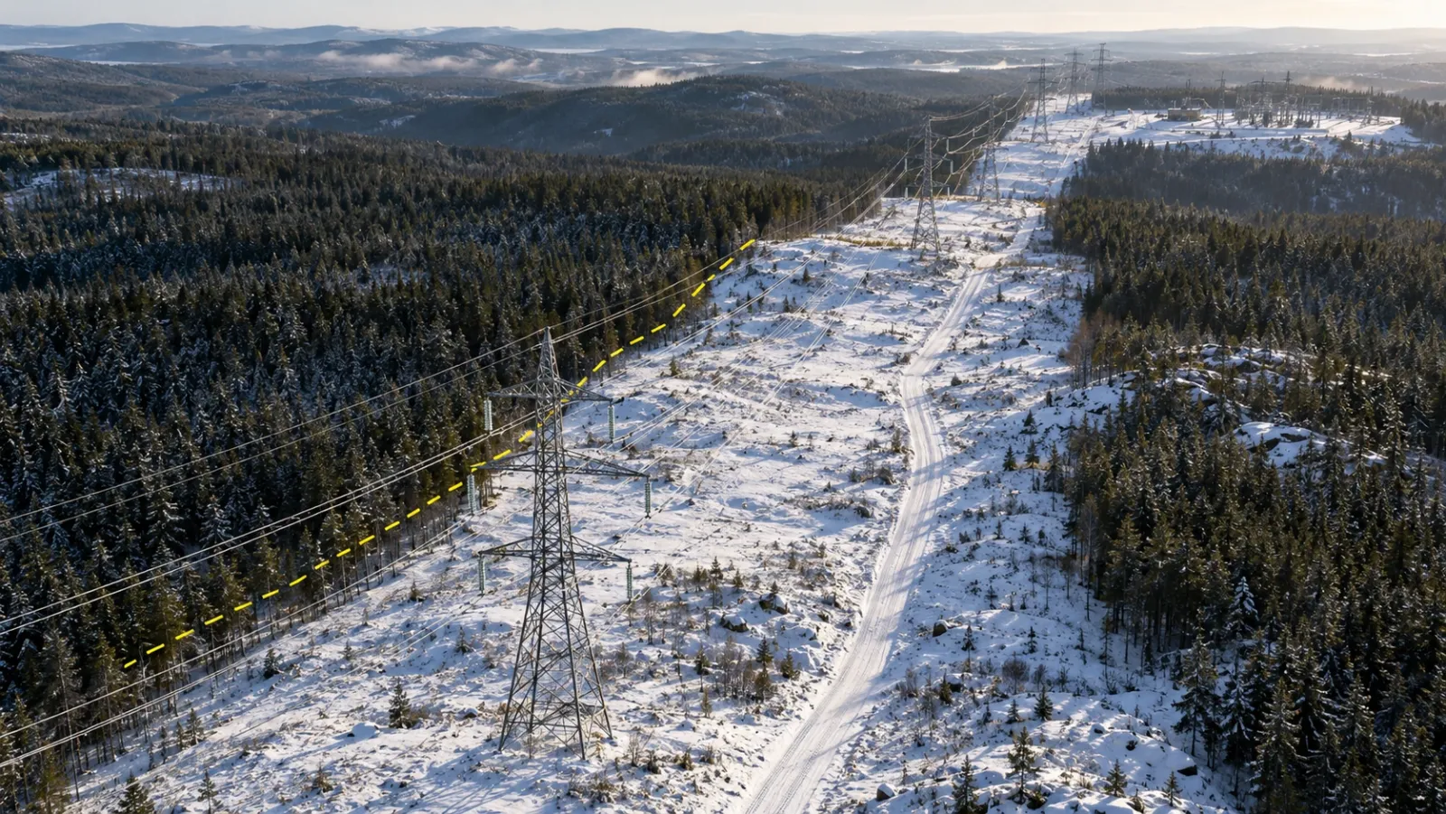
Power line drone inspection uses drones carrying high-resolution cameras, thermal sensors and sometimes LiDAR to check transmission and distribution lines, their towers and poles, and the substations they connect. Nobody climbs a structure to collect the data, and in most cases the line stays in service. The flights find damaged insulators, loose or missing fittings, worn conductors, corrosion, overheating connections and trees growing too close to the wires, and each finding is recorded against a known structure and phase.
At YelloSKYE, grid inspection runs through Inspect IQ, our asset inspection solution. Below we cover what a drone looks for, how tower and corridor flights differ, which sensor answers which question, the safety and permission work before any flight, how images become a ranked repair list, and what still needs a person on the structure. For thermal physics and electrical heat signatures, see our guide to drone thermal inspection; this one only touches on them.
Why network owners are moving line inspection to drones
Overhead networks have long been inspected in three ways, each with a gap.
An inspector on foot sees only the underside of each insulator and fitting; the top of a crossarm, where pins, bolts and clamps sit, stays hidden. Helicopters cover long routes fast but spend little time per structure. Climbing gives the best view but puts people at height and often needs an outage. A drone holds position beside a fitting, looks straight down onto a crossarm, and repeats the angle next cycle.
| Method | What it does well | Where it falls short |
|---|---|---|
| Foot or vehicle patrol | Ground-level damage, access, obvious faults | Upper faces of fittings, detail at height, remote spans |
| Helicopter patrol | Long routes in a short time, broad corridor view | Little time per structure, high operating cost, crew exposure |
| Climbing inspection | Hands-on checks, torque and electrical tests | Work at height, slow, often needs an outage |
| Drone close-up flight | Every face of every fitting from set angles, repeatable | Battery endurance, wind, field effects near conductors |
| Drone corridor mapping | Vegetation, encroachment, terrain and access, all measurable | Less component detail than close-up work |
What a drone inspection finds
Insulators
Insulators get the most attention because a failed string can drop a conductor. A shattered glass disc leaves its metal cap and pin exposed, which is easy to spot from the air. Porcelain chips and cracks, and flashover leaves burn marks on the glaze. Polymer (composite) insulators fail differently: sheds split or show tracking and erosion, birds peck at them, and end fittings corrode where they meet the housing. Pollution near coasts and heavy industry shows as a discoloured film.
Hardware and fittings
Small parts cause many line failures. Close-up images show missing split pins on shackles and clevises, nuts backing off, worn links, vibration dampers that have slipped or lost a weight, broken spacers on bundled conductors, and damaged arcing horns or grading rings.
Conductors and earth wires
A zoom camera picks up broken outer strands, birdcaging where strands have opened near a clamp, lightning burns, and debris such as plastic sheeting or kite string caught on the wires. The earth wire or optical ground wire along the top of the towers gets the same check.
Towers, poles and foundations
Lattice towers show bent or missing members, missing bolts and corroded galvanising. Wooden poles show rot and splits; concrete poles show cracking and spalling. Corridor imagery reveals erosion or subsidence around footings, and bird nests on crossarms, which can cause flashovers.
Hot joints and connectors
A compression joint, jumper or dead-end connection with rising contact resistance runs warmer than the conductor on either side once current flows. A radiometric thermal camera finds these under load. Our thermal inspection guide explains how such readings should be corrected and read.
Vegetation and encroachment
Trees growing towards the conductors or tall enough to fall into the line, new structures beneath it and ground raised by tipping all reduce clearance. Vegetation contact is a common cause of unplanned outages, especially on rural lines.
Substations
Inside the fence, drones record bushings, oil staining around transformers, disconnector contacts, busbar clamps, surge arresters and gantry steelwork. Thermal views of connections are usually the main reason to fly.
| Component | Typical defect | Best sensor | Usual follow-up |
|---|---|---|---|
| Glass or porcelain insulator | Shattered disc, chips, flashover burns | Close-up RGB | Replace the string at a planned outage or by live-line crew |
| Polymer insulator | Split sheds, tracking, corroded end fitting | Close-up RGB | Specialist assessment and replacement |
| Fittings and hardware | Missing pins, loose nuts, slipped dampers | Close-up RGB, looking down | Targeted climb or live-line repair |
| Conductor and earth wire | Broken strands, birdcaging, debris | Zoom RGB | Repair sleeve, debris removal |
| Joints and connections | Overheating from high resistance | Radiometric thermal under load | Confirm, then remake or replace |
| Steelwork and footings | Corrosion, missing members, erosion | RGB and corridor mapping | Painting campaign, steel or civil repairs |
| Corridor | Vegetation inside clearance, encroachment | LiDAR or photogrammetry | Cutting programme, owner notification |
How tower and corridor inspections are flown
Close-up structure inspection
The drone stops at each tower or pole and works through a fixed shot list: overall views from set directions, then each phase from both sides, both ends of every insulator string, the conductor attachment, the earth wire peak and downward views onto the crossarm tops. Agree the owner's numbering for lines, structures and phases first, so every image is filed to a tower, phase and component. Pre-programmed paths repeat the same positions next cycle, which makes year-on-year comparison possible. This is the flight that finds missing pins and cracked discs.
Corridor mapping
Corridor flights work along the route at greater height, often following the terrain, and collect overlapping imagery for an orthomosaic and elevation model, or a LiDAR point cloud. The result shows the right of way as a whole: tree lines, encroachments, access tracks and ground movement near footings. YelloSKYE's linear corridor mapping use case describes this approach on highways, pipelines and railways, with terrain-following flight paths sized to the corridor width and georeferenced maps covering the full length of the asset. How those maps are produced is set out in our guide to what an orthomosaic is.
Choosing the sensor
| Sensor | Question it answers | Conditions it needs | Watch out for |
|---|---|---|---|
| High-resolution RGB with zoom | What condition is each component in? | Good light, low wind | Records the surface only |
| Radiometric thermal | Is a connection running hot? | Line under meaningful load, dry weather | Lightly loaded lines hide faults; small targets need close passes |
| LiDAR | How close are trees, ground and structures to the conductors? | Works in flat light and through gaps in canopy | Captures sag at one moment only |
| Ultraviolet (corona) camera, used by some utilities | Is there electrical discharge on insulators or fittings? | Low background ultraviolet, often dawn or dull days | Needs specialist interpretation |
With LiDAR, remember that conductor sag changes with temperature and load, so the clearance measured on a cold morning with a lightly loaded line is larger than it will be on a hot afternoon at full rating. Line engineers therefore model the captured conductor out to the worst-case condition in the line's design rules before deciding whether a tree is too close.
YelloSKYE's automated asset inspection use case describes multi-sensor payloads carrying RGB, thermal and LiDAR together, processed into a 3D digital twin on which every finding carries GPS coordinates. For a line, flying the sensors together means one site visit answers several questions.
Substations
Substations are dense, fenced and full of steel and live equipment, so flights are planned with the substation operator and often flown from inside the yard under escort. A mapping pass gives an overview of the site; detail and thermal passes then cover bushings, disconnectors and busbar connections. Flight paths keep the aircraft clear of energised plant and avoid holding position directly above it, so a fault in the drone cannot bring it down onto live equipment.
Safety distances and permissions
Distance from energised equipment
No single stand-off distance fits every line. Network owners set minimum approach distances by voltage for people and equipment, and drone crews apply those rules with an extra margin of their own. Three hazards shape the margin:
- Thin wires are hard to see. Earth wires and small conductors can be invisible against a bright sky, and many obstacle-avoidance systems do not detect them reliably.
- Fields disturb navigation. Strong electromagnetic fields around high-voltage conductors and large steel structures can upset a drone's compass. Crews test behaviour near the structure first and use zoom lenses for detail rather than flying closer.
- Never pass between phases. Paths stay outside the conductor envelope and avoid crossing beneath a span.
Winter flying adds its own risks: batteries lose capacity in the cold, ice can build on propellers, and snow glare makes conductors even harder to see from the controller.
Permissions
Aviation rules come first: each country's regulator, such as the GCAA in the UAE, the CAA in the UK or the FAA in the US, sets the conditions for flying near infrastructure. Long corridors may need approval to fly beyond visual line of sight, or a plan that moves the crew along the route. Many countries treat substations as critical infrastructure, with flight restrictions or a need for the operator's consent. Take-off points along a route often sit on private land, so landowner access must be arranged. The network's control room should also know where the drone is working, so it is not mistaken for an incident. Rules change, so check them for every project.
From images to a prioritised maintenance list
Thousands of images matter only once they become a short, ranked list of work.
- Detect. AI models trained on inspection imagery flag candidate defects such as cracks, corrosion and thermal anomalies, and geotag each one. An engineer reviews every flag, because a model's suggestion is not a diagnosis.
- File. Each confirmed finding is tied to line, structure number, phase, side and component, matching the owner's asset register.
- Grade. Each finding gets a priority based on what would happen if it failed and how soon that could happen.
- Package. Work is grouped by access method: items needing an outage go into the next planned outage, items suited to live-line work go to that crew, and vegetation goes to the cutting contractor.
- Hand over. Findings move into the maintenance system as work orders with images attached.
- Close and compare. A repair is closed only when later imagery shows it done, and the next cycle compares each structure with its previous record.
Priority classes belong to the network owner and vary between utilities, but most follow a pattern like this:
| Priority | Typical findings | Typical response |
|---|---|---|
| Immediate | Conductor badly damaged, fitting close to letting go, tree touching or about to touch a phase, connection far hotter than its neighbours | Report to the control room the same day; emergency repair |
| Urgent | Shattered disc in a string, missing pin on a load-carrying shackle, vegetation inside the clearance zone | Repair in the next short maintenance window |
| Planned | Surface corrosion on steelwork, slipped damper, minor chips on porcelain | Add to the next planned outage or campaign |
| Monitor | Early discolouration, light tracking, vegetation approaching but still clear | Recheck and compare at the next inspection |
Inspect IQ hands over a structured defect database: for each entry, annotated images, GPS coordinates, a severity rating and a recommended remedy, which can be exported as PDF or Excel files or in BIM-linked formats. Inside DEX, every defect is pinned to its spot on the captured structure, maintenance dashboards track open items, severity and how fast they are resolved, and a slider between capture dates shows when a defect first appeared.
The logic matches YelloSKYE's solar farm thermal inspection work, where the software marks hot spots, failed diodes and disconnected strings at their GPS positions so crews walk straight to the faulty module. On a line, the module address becomes a tower number and a phase.
What drone inspection cannot do
A drone survey is the first stage of line maintenance, not the whole of it.
- It sees surfaces only. Internal damage in polymer insulators, corrosion of a conductor's steel core and buried foundations need other tools.
- It tests nothing. Insulator electrical tests, earthing resistance and bolt torque need technicians and instruments.
- Thermal depends on load. A lightly loaded line can hide a bad joint.
- Clearance is a snapshot. Sag and growth change, so LiDAR results are modelled forward.
- Weather limits flying. Wind, rain, low cloud and icing ground the aircraft.
- It repairs nothing. Fixes need a crew, and often an outage or live-line procedure.
Handled this way, the drone narrows the field: climbing crews go to the structures that need them, carrying the right parts, instead of climbing every tower to find the few with problems. The same order of work applies to bridges, as our guide to drone bridge inspection describes.
Checklist: planning a power line drone inspection
- State the purpose: routine condition, vegetation, thermal or post-storm.
- Get the asset register with line names, structure numbers and phase naming.
- Agree priority classes and response times with the maintenance team.
- Confirm permissions: aviation authority, beyond-visual-line-of-sight approval if needed, landowners, substation operators and the control room.
- Take minimum distances from the network owner's rules and add a margin.
- Fly thermal under load, and log conductor load and temperature with LiDAR captures.
- Repeat the same shot list at every structure, every cycle.
- Have an engineer review automated flags, raise work orders, and close each with evidence.
Frequently asked questions
How do drones inspect power lines?
Most programmes combine two kinds of flight. Corridor mapping flies along the route to record the right of way, vegetation, access tracks and ground conditions, while close-up structure flights stop at each tower or pole and photograph every insulator, fitting and conductor attachment from fixed positions. Thermal capture is added when the line is carrying load, to find connections running hot.
Do power lines have to be switched off for a drone inspection?
Usually not. Visual, thermal and LiDAR inspection is normally carried out with the line energised, and thermal work actually needs current flowing to show faults. The drone keeps the distance set by the network owner's safety rules. Repairs that the inspection identifies may still need a planned outage or a live-line crew.
What defects can a drone find on a transmission line?
A drone records shattered or chipped insulator discs, flashover burns, damaged polymer sheds, missing split pins and bolts, slipped dampers and spacers, broken conductor strands, objects caught on the wires, corrosion on steelwork and fittings, bird nests on crossarms and trees growing towards the conductors. With a thermal camera under load it also finds joints and clamps that are overheating.
How close can a drone fly to a live power line?
There is no single figure. The distance depends on the voltage, the aircraft, the network owner's minimum approach rules and the national aviation authority. Strong electromagnetic fields near high-voltage conductors can disturb a drone's compass, so experienced crews keep a generous margin and rely on zoom lenses for detail rather than flying closer.
How often should overhead lines be inspected?
The network owner's maintenance policy and local regulation set the interval. A common pattern is regular patrols, a detailed structure-by-structure inspection on a longer cycle, a vegetation survey before each growing season, and extra flights after storms, icing or wildfire risk periods. Repeating the same flight plan each time makes results comparable.