Environmental Monitoring with Drones: Baselines, Repeat Surveys and Compliance Evidence
By Kush Agarwal, President and CEO, YelloSKYE. Published .
Executive Summary
- The Question: How do you use drone surveys to monitor the environmental effects of a project or the condition of an estate, in a way that stands up when a regulator asks for evidence?
- The Answer: Record a baseline before disturbance, choose a few indicators that show on the surface (erosion, drainage, vegetation, water, landform, heat), and repeat the survey with the same method at a set interval. The comparison between dated surveys, not any single flight, is the evidence.
- The YelloSKYE Angle: Survey IQ produces terrain models, water flow simulation and land use and land cover classification from drone surveys, and the DEX platform keeps each survey as a timestamped, georeferenced record that can be compared with the baseline.
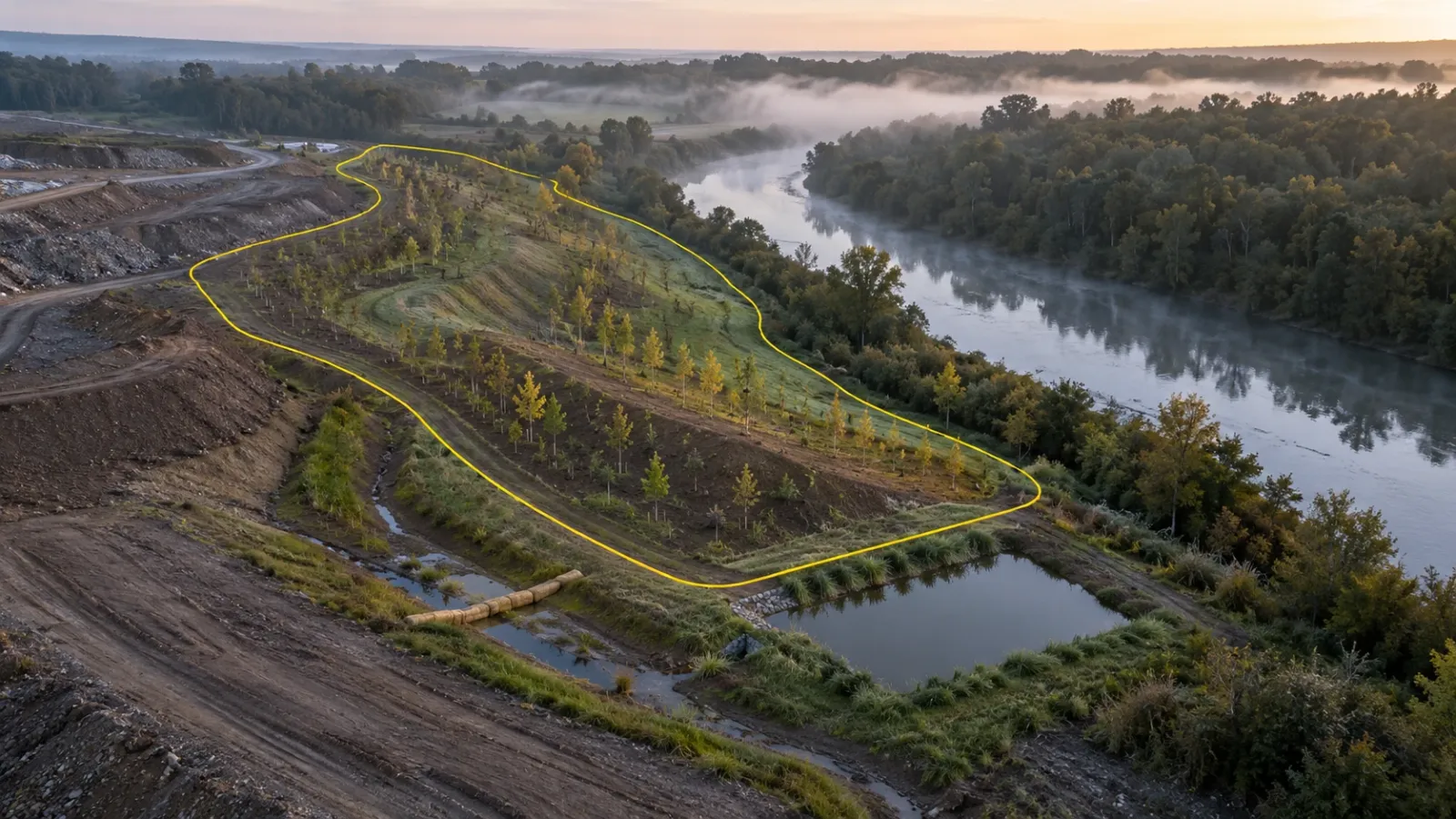
Environmental monitoring with drones means surveying land at regular intervals to measure how it is changing: soil washing off a slope, water collecting where it should not, vegetation cleared or returning, a stream changing course, or restored land settling into its final shape. Each survey is a measurable map and terrain model, so change can be calculated rather than described, and the record can be shown to a regulator, an owner or a community.
YelloSKYE handles this kind of work through Survey IQ, our land survey and terrain solution. This guide explains what a drone can and cannot monitor, how to set a baseline, how to design repeat surveys that compare properly, and how to turn the results into evidence for permit conditions. For how the terrain itself is surveyed, see our drone topographic survey guide.
What drones can and cannot tell you
A drone sees the surface of the land. It is very good at anything that shows up as a change in shape, colour, extent or surface temperature, and it covers ground that would take a field team days to walk, including wetlands, steep slopes and areas with difficult access.
It does not take samples. Water quality, soil chemistry, dust levels, noise and species counts all need field measurement or fixed instruments. A sensible programme uses the drone to show where and how much the land has changed, and field work to explain why and to measure what the camera cannot.
Indicators worth monitoring
Pick a short list of indicators that relate to the project's actual risks and permit conditions. Monitoring everything produces data nobody reviews.
| Indicator | What is measured | Sensor | Output | Field check |
|---|---|---|---|---|
| Erosion | Rills, gullies, slope loss, sediment deposits | RGB camera, terrain model | Elevation change map, eroded volume | Inspect controls on site |
| Drainage | Flow paths, ponding, blocked channels | Terrain model | Flow simulation, low-point map | Confirm outfalls and culverts |
| Vegetation cover | Extent, canopy, clearing limits | RGB or multispectral | Land cover map, cover by area | Ground plots for species and health |
| Water bodies | Shoreline, pond extent, visible plumes | RGB, sometimes thermal | Water outlines, area change | Water samples for quality |
| Landform | Shape of restored or reshaped ground | Terrain model | Comparison with design surface | Spot levels, soil depth |
| Surface heat | Temperature of paving, roofs, vegetation, discharges | Radiometric thermal | Temperature map | Surface or air temperature readings |
| Disturbance footprint | Clearing and works outside approved limits | Orthomosaic | Boundary overlay, encroachment areas | Site walk at flagged points |
The baseline survey
The baseline is the most important flight in any environmental programme, because it is the only one that cannot be repeated. Once vegetation is cleared or a slope is regraded, the original condition is gone.
When to fly it
Fly before any clearing or earthworks, ideally in the season the repeat surveys will use. Vegetation looks very different in spring and late summer, and water bodies change with the wet and dry seasons, so a baseline taken in one season and compared with a survey from another will show change that is only seasonal.
What it should contain
- A georeferenced orthomosaic of the whole site and a buffer around it, since effects often extend past the boundary.
- A bare-earth terrain model, with drainage paths and low points analysed on it.
- A land use and land cover classification, separating vegetation, water, bare ground and hard surfaces.
- Thermal or multispectral layers, only where an indicator needs them.
- Fixed photo points on the ground, photographed from the same position each time.
- Permanent ground control, protected so later surveys can tie to exactly the same reference.
In our drone land survey for site feasibility use case, one drone mobilisation produced boundary checks, terrain models, land cover classification and water flow simulation before a parcel was bought. That same dataset makes a strong environmental baseline.
Designing repeat surveys that compare properly
Change is only meaningful when the method is held constant. If the flight height, sensor, season or control changes between surveys, part of the difference will come from the method rather than the land.
| Keep constant | Why |
|---|---|
| Flight plan, height and overlap | Same resolution and coverage each time |
| Ground control and coordinate system | Surfaces line up without shifts |
| Sensor and settings | Colours, bands and temperatures are comparable |
| Season and time of day | Vegetation, water and shadows are similar |
| Processing and classification rules | The same land is labelled the same way |
How change is measured
- Elevation difference between two terrain models shows where ground has been lost or gained and how much, which is how erosion and sediment build-up are quantified.
- Classification change compares land cover maps to show areas cleared, revegetated or newly paved.
- Outline change compares the edges of water bodies, cleared areas and planting zones.
Set thresholds in advance. A change larger than the survey's accuracy, over a defined area, triggers a site inspection; anything smaller is recorded but not acted on. This keeps the programme focused and stops noise from being reported as damage.
Erosion, sediment and drainage on project sites
Construction and earthworks sites are where most environmental drone monitoring happens. Exposed soil, stockpiles and new drainage all create a risk of sediment leaving the site. Regular surveys show whether silt fences, check dams and sediment basins are in the right places and still working, and a terrain model can measure how much a sediment basin has filled and when it needs clearing.
A survey after heavy rain is especially useful, because it shows where water actually went rather than where the drainage design expected it to go. Our flood risk and drainage planning use case runs water flow simulation on drone terrain to find accumulation zones and flow paths, and the same analysis on a live site points to where controls are needed next. On long corridors such as roads and pipelines, the linear corridor mapping use case shows how a continuous, timestamped archive supports compliance reviews over many kilometres.
Vegetation and land cover
Most vegetation monitoring answers simple questions: how much is there, where, and is it more or less than last time? An RGB orthomosaic with a land cover classification answers these well, and it shows clearing beyond approved limits clearly when the boundary is overlaid.
Multispectral cameras add bands such as near-infrared. Plants reflect these differently as their condition changes, and indices such as NDVI are calculated from them to highlight stressed or sparse growth. Treat these as relative maps, calibrate with ground plots, and survey at the same point in the growing season each year.
Water bodies and wetlands
Drones can map shorelines, pond extents, channel movement and visible plumes of sediment, and can reach wetlands and riverbanks where access on foot is slow or unsafe. They cannot measure water quality, so pair each survey with field sampling at fixed points, and use the drone map to choose where those points should be.
Surface heat
A radiometric thermal camera records surface temperature across a site. Environmental uses include comparing surface temperatures of paving, roofs and planted areas before and after green infrastructure is installed, and spotting warm discharges into watercourses. Timing matters: surfaces heat and cool through the day, so repeat surveys need the same time of day and similar weather. Our drone thermal inspection guide explains how thermal cameras work and the conditions they need.
Restoration and rehabilitation
Restoring quarries, mines, borrow pits and temporary works areas often takes years, and progress is usually reported against an agreed plan. Drone surveys compare the reshaped landform with the design surface, measure topsoil placed, and track vegetation cover and erosion season by season. For mine and quarry sites, our drone mining survey guide covers how rehabilitation fits alongside the operational survey work.
Turning surveys into compliance evidence
Environmental conditions and the evidence a regulator expects differ by country, by agency and by permit. Whatever the setting, a monitoring report is stronger when someone who was not there can see exactly what was done and repeat it.
| Report item | What to include |
|---|---|
| Survey details | Date, time, weather, sensor, flight height, area covered |
| Accuracy | Control used and checkpoint results |
| Method | How change was calculated and the thresholds applied |
| Comparison | Change since baseline and since the last survey, by indicator |
| Findings | Locations exceeding thresholds, with map extracts and photos |
| Actions | What was inspected or fixed, and when |
Flights themselves are regulated separately, by the national aviation authority in each country. Sensitive areas such as wildlife reserves may also carry their own restrictions on flying, so check both before the first survey.
How Survey IQ supports environmental monitoring
Survey IQ produces georeferenced orthomosaics, DEM and DTM terrain models, water flow simulation and land use and land cover classification that separates hard surfaces, vegetation, water bodies and open ground. Survey IQ's change detection flags what has changed between survey intervals. Each survey is stored in the DEX platform as a timestamped, georeferenced record, which teams can use for internal reviews, consultant coordination and environmental clearance or drainage approval submissions. Data exports to GIS and CAD formats such as GeoTIFF, DXF and LAS, so environmental consultants can work with it in their own tools.
Checklist for an environmental drone programme
- Read the permit conditions and list the indicators they require.
- Fly the baseline before any disturbance, in the season you will repeat.
- Install permanent ground control and protect it for the life of the project.
- Fix the method: flight plan, sensor, time of day, processing and classification rules.
- Set thresholds that trigger a site inspection, larger than the survey's accuracy.
- Add surveys after heavy rain on active earthworks sites.
- Pair drone surveys with field sampling for water, soil and species.
- Report change against the baseline, with method, accuracy and actions taken.
- Check aviation rules and any local flight restrictions for sensitive areas before flying.
Frequently asked questions
What can drones monitor for environmental compliance?
Drones measure things that show on the ground surface: erosion and sediment build-up, drainage paths and ponding, vegetation cover, the extent of water bodies, the shape of restored land and, with a thermal camera, surface temperature. They are less suited to things that need a sample, such as water chemistry, soil contamination or air quality, which still need field measurement.
Why is a baseline survey important for environmental monitoring?
A baseline records the condition of the land before work starts, so every later survey can be compared with it. Without one, there is no reliable way to show whether erosion, clearing or drainage changes were caused by the project or were already there. It cannot be recreated once the ground has been disturbed.
How often should environmental drone surveys be repeated?
It depends on what is being watched and what the permit asks for. Active construction sites often fly monthly and after heavy rain to check erosion and sediment controls, while restoration and vegetation are usually surveyed once or twice a year in the same season. Choose a schedule that matches the pace of change and the reporting dates.
Can a drone measure vegetation health?
A standard camera shows cover and canopy extent well. A multispectral camera records light in bands, including near-infrared, that plants reflect differently when healthy or stressed, and vegetation indices such as NDVI are calculated from those bands. The index shows relative differences, so it should be checked against ground plots before being used to judge health.
Are drone surveys accepted as evidence for environmental permits?
Acceptance depends on the regulator and the permit conditions, which vary by country and project. Dated, georeferenced surveys with a clear method and accuracy statement are generally strong supporting evidence, especially alongside field records. Agree the format with the regulator or the permit holder's environmental adviser early.