Drone Mining Survey: Mapping Pits, Benches, Haul Roads and Rehabilitation
By Kush Agarwal, President and CEO, YelloSKYE. Published .
Executive Summary
- The Question: Where do drones fit in the survey work of a mine or quarry, and how often should each part of the site be flown?
- The Answer: A drone records the whole operation as a measurable surface: pit and benches, blasts, stockpiles, haul roads, highwalls, water and rehabilitated ground. The value comes from flying on a fixed cadence and comparing each survey with the mine plan and the one before, while keeping people off unstable ground.
- The YelloSKYE Angle: Survey IQ produces terrain models, contours, volumes and change detection from drone flights, and the DEX platform keeps every survey on a shared timeline that survey, planning and environmental teams can measure from.
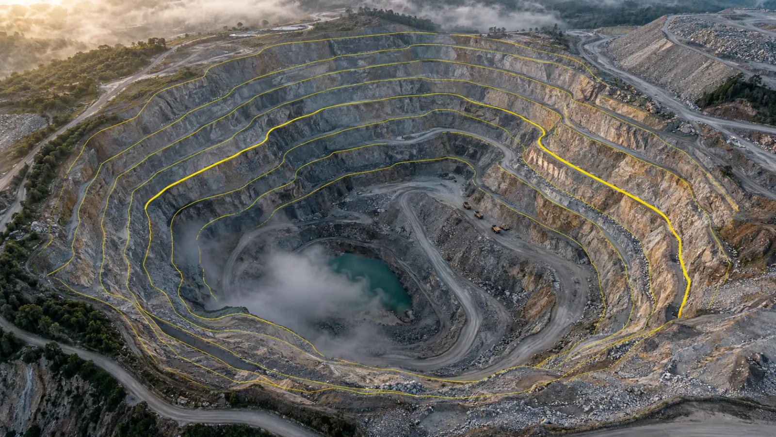
A drone mining survey uses aerial mapping to measure a mine or quarry: the shape of the pit and benches, the volume of material moved and stockpiled, the condition of haul roads and walls, and the state of land being rehabilitated. Each flight produces an orthomosaic, a terrain model and a point cloud tied to the mine grid, so the survey team can measure the whole operation from one dataset rather than walking it.
At YelloSKYE, this work runs through Survey IQ, our land survey solution. This guide looks at the mine as a whole: which survey jobs a drone handles well, where ground instruments and monitoring systems still lead, how flights fit into an operating site, and how often to fly each area. For the detail of measuring individual piles, see our guide to stockpile volume measurement.
Why mine survey suits the drone
Mines and quarries combine three things that make ground survey slow and risky: large areas, constant change and dangerous ground. Faces are blasted, benches advance, stockpiles grow and shrink every shift, and the most important surfaces are often the ones nobody should stand on. A survey crew picking points along crests and toes covers a fraction of the site in a day and has to work near haul traffic and unsupported edges.
A drone flight records the whole surface in one pass from a safe launch point. YelloSKYE's drone surveys cover 50–200 hectares a day, which on many quarries means the entire site, dumps included, in a single visit. The change is not only speed. Because every survey covers everything, two surveys can be compared anywhere on site, not only where someone happened to take readings.
Survey jobs a drone handles across a mine
| Survey job | What the drone records | Typical output | Main users |
|---|---|---|---|
| Pit and bench mapping | Crests, toes, berms and face shape | Terrain model, crest and toe strings, contours | Mine planning, survey |
| Blast planning and review | Face profile before; muckpile and throw after | Face point cloud, muckpile volume | Drill and blast |
| Stockpile inventory | ROM pad and product piles | Volumes and tonnages by pile | Survey, finance |
| Haul road condition | Width, gradient, cross-fall, berms, ponding | Orthomosaic, long and cross sections | Mine operations, safety |
| Highwall and slope review | Cracks, rockfall, bulges, loose material | High-detail model, change maps | Geotechnical |
| Waste dumps and tailings | Dump slopes, lift heights, dam crests, pond extent | Volumes, levels, pond area | Planning, environmental |
| Rehabilitation and closure | Final landform, topsoil placement, vegetation cover | Terrain against closure design, cover maps | Environmental, closure |
Pit and bench mapping
The core monthly job is recording what the pit looks like now and comparing it with the mine plan. A drone terrain model gives crest and toe lines for every bench, so the team can check berm widths, bench heights and overall slope against design, and calculate the volume mined in the period by comparing with last month's surface. The method is the same as earthworks on a construction site; our cut and fill volumes guide covers the surface comparison and the bank, loose and compacted conversion in detail.
Where the design calls for a minimum berm width to catch rockfall, the crest line from the drone shows quickly whether a bench has been mined too close to the wall. Over-break behind the design crest is also easy to see, and it matters: a lost berm cannot be rebuilt, and it changes the safety case for the wall below.
Faces and geology
Vertical faces are poorly seen from directly above. Oblique flights along the face add a detailed 3D view that geologists use to map contacts and structures, and that drill and blast engineers use to check burden on the front row.
Before and after the blast
Before a blast, a face model helps confirm burden and front-row hole positions. After the blast and once the area has been cleared for re-entry, a second flight records the muckpile shape, throw and any damage behind the crest. Comparing the two surfaces gives a blasted volume, and repeating it over many blasts helps the team adjust designs. Drone flights must never go near a blast area until the site's clearance procedure allows it.
Stockpiles and inventory reconciliation
Most mines measure ROM pads and product stockpiles at month end and reconcile them against the tonnes recorded by weighbridges and belt scales. A drone survey gives a volume for every pile on the same day, which is then converted to tonnes with a site-tested density. The method, base surfaces and reconciliation routine are covered in the stockpile volume measurement guide; the point to add here is timing. Fly as close as possible to the accounting cut-off, and survey every pile on the site in the same flight so that material moving between piles does not get counted twice or missed.
Haul roads
Haul roads carry the heaviest traffic on site and are rebuilt and extended constantly. An orthomosaic and terrain model show the details that matter for safe running:
- Gradient along the ramp, compared with the design limit for the truck fleet.
- Cross-fall and drainage, including standing water and soft spots after rain.
- Running width compared with the width the site standard requires for the largest trucks.
- Safety berm (windrow) height along open edges, checked against the site's own standard.
- Surface defects such as potholes and spillage that raise tyre wear and maintenance costs.
Long sections and cross sections cut from the drone surface give the road crew a clear list of where to work, without anyone standing in the traffic to measure.
Highwalls and slopes
Drone surveys add detail to slope management, but they do not replace continuous monitoring. Radar, prisms and other instruments watch a wall around the clock and raise alarms; a drone visits on a schedule. What the drone does well is give geotechnical engineers a high-resolution view of the whole wall without anyone approaching the crest: tension cracks behind the edge, fresh rockfall at the toe, loose blocks on the face and changes in shape since the last flight. Change detection between two surveys highlights where the wall has moved enough to justify a closer look.
Tailings, water and waste dumps
Waste dumps are surveyed for volume, lift height and overall slope, and their outer faces for erosion and slumping. On tailings storage facilities, drone surveys record crest levels, beach extent and pond area, which feed the freeboard and water balance checks the facility's engineers run. Water on site, whether in pit sumps, sediment ponds or drainage channels, can be mapped from the same terrain model. Our flood risk and drainage planning use case shows water flow simulation run on drone terrain to locate low points and flow paths, the same analysis a mine uses to plan its surface water management.
Rehabilitation and closure
Rehabilitation is a long programme of reshaping, spreading topsoil and revegetating disturbed land, usually against a closure plan agreed with the regulator. Drone surveys measure the reshaped landform against the closure design, record topsoil volumes placed, and map vegetation cover and erosion over time. A run of dated surveys is often the clearest evidence of progress for regulators, landowners and the people deciding on release of financial security. We cover the monitoring side, including baselines and repeat surveys, in our guide to environmental monitoring with drones.
The safety case
Safety is often the reason a mine starts using drones, ahead of cost or speed.
| Hazard in ground survey | Exposure on foot | With a drone |
|---|---|---|
| Walking stockpiles | Unstable, collapsing faces | Pile measured from the edge of the pad |
| Pit crests and highwalls | Working near unsupported edges | Wall recorded from a safe stand-off |
| Haul roads | Surveying among heavy trucks | Road measured from the air between trucks |
| Muckpiles after blasting | Loose rock and misfire risk | Surveyed from a distance once cleared |
| Tailings beaches | Soft ground and water | Levels taken without access |
Flying on a working mine
A mine is an industrial site with its own rules, and drone flights have to fit into them. Coordinate each flight with dispatch, keep clear of blast exclusion zones and timings, plan take-off and landing away from haul roads and fixed plant, and brief the control room on the flight area. The aviation rules for drones, such as altitude limits, operator licences and flight beyond visual line of sight, differ by country. Each national aviation authority sets its own; the FAA (US), the CAA (UK) and the GCAA (UAE) are three examples. Check both the mine's rules and the aviation rules before planning a programme.
Survey cadence across the site
Different parts of a mine change at different speeds, so one interval for the whole site is rarely right.
| Area | Typical cadence | What drives it |
|---|---|---|
| Active pit and benches | Monthly, or more often in fast advance | End-of-month volumes and plan conformance |
| Blast areas | Before and after each blast, where needed | Blast design and review |
| ROM and product stockpiles | Monthly at cut-off; weekly if throughput is high | Inventory reconciliation |
| Haul roads under construction | Weekly | Gradient and width checks during building |
| Highwalls of concern | As set by the geotechnical engineer | Change detection between surveys |
| Waste dumps and tailings | Monthly or quarterly | Volume, lift heights, crest levels |
| Rehabilitation areas | Seasonally or yearly | Landform, cover and erosion reporting |
Whatever the cadence, use the same flight plan, control and processing each time. Comparisons between surveys are only meaningful when the method stays fixed.
How Survey IQ fits a mine survey programme
Survey IQ flies RTK-GNSS drones with ground control points and delivers orthomosaics, contour maps, terrain and surface models, slope analysis, point clouds and volumetric reports. Data exports as DWG and DXF, GeoTIFF and LAS or LAZ, so it opens in CAD, GIS and planning software in the mine's own grid. Change detection highlights what moved between survey intervals, and the DEX platform keeps every flight on a timeline that anyone with access can measure in a browser, which helps when survey, planning, finance and environmental teams all draw on the same data. On a highway job described in our earthwork volumetric analytics use case, the same approach cut survey turnaround from two weeks to a few hours.
For a new pit extension or an adjacent parcel, a baseline survey before disturbance records terrain, drainage and land cover, as the land survey for site feasibility use case shows. That first surface is the reference for every volume and every rehabilitation comparison that follows.
Starting a mine survey programme
- List the survey jobs the drone will take on, and the jobs that stay with ground instruments and monitoring systems.
- Fix the coordinate system, height datum and file formats with the mine planning team.
- Set permanent ground control around the site, plus checkpoints for every survey.
- Write flight procedures with operations: dispatch contact, blast clearances, launch points and exclusion zones.
- Confirm aviation permissions with the national aviation authority before the first flight.
- Agree a cadence per area, timed to month-end and other reporting dates.
- Fly a full-site baseline before new disturbance, and keep it as the reference surface.
- Keep every survey in one place, dated and comparable, so change can be measured at any point on site.
Frequently asked questions
What is a drone mining survey?
It is the use of drones to map and measure a mine or quarry from the air: the pit, benches, stockpiles, haul roads, waste dumps, water and rehabilitated land. The flights produce orthomosaics, terrain models and point clouds that the survey, planning and environmental teams measure from, in place of walking the site with ground instruments.
How often should a mine or quarry be surveyed by drone?
Most operations fly the whole site at least once a month for end-of-month volumes and reconciliation. Active blast areas, fast-moving stockpiles and haul roads under construction are often flown weekly, while rehabilitated areas may only need a survey each season. Set the interval by how quickly each area changes and which report depends on it.
Can drones be flown over an active mine?
Yes, but only inside the mine's own operating procedures and the national aviation rules. Flights are usually coordinated with dispatch and the blasting schedule, kept clear of blast exclusion zones, and planned around haul traffic and fixed plant. The aviation rules differ by country, so check them with your national aviation authority.
Can a drone replace slope stability radar on a highwall?
No. Radar and prism monitoring track wall movement continuously and raise alarms, which a periodic drone flight cannot do. Drone surveys add a detailed picture of the wall between visits, showing new cracks, rockfall and changes in shape, and help geotechnical engineers decide where to look more closely.
What file formats do mine planning teams need from a drone survey?
Typically a terrain surface or contours in DXF or DWG, an orthomosaic in GeoTIFF and point clouds in LAS or LAZ, all in the mine's own coordinate system and height datum. Confirm the formats and the grid with the mine planning software team before the first flight, so data can be used without conversion.