Drone Property Condition Assessment: Faster Site Visits and Clearer Reports
By Kush Agarwal, President and CEO, YelloSKYE. Published .
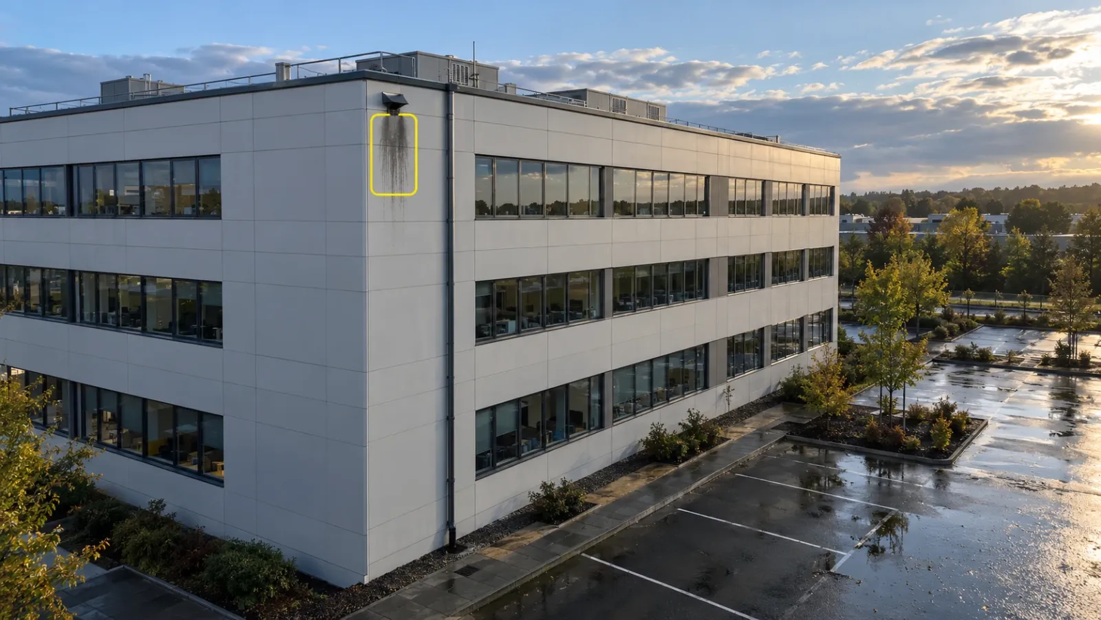
Executive Summary
- The Question: How do drones and ground-level imagery fit into a property condition assessment, and how should the resulting report be organised?
- The Answer: Aerial capture covers the roof, upper facades, grounds and car parks in one short visit, while ground-level and 360° capture records interiors and plant. The assessor then spends site time on services, safety systems and anything that must be touched or tested, and the report ties every defect to a location, a photo, a severity and a cost horizon.
- The YelloSKYE Angle: Inspect IQ captures building exteriors with RGB, thermal and LiDAR drone sensors while the property stays in use, and DEX keeps each property's captures, findings and earlier dates in one place, which is what makes a portfolio comparable.
A property condition assessment records what state a building is in and what it will cost to keep it serviceable. Drones make the exterior part of that job faster and more complete: one flight captures the roof, the upper walls, the grounds and the car park, so the assessor no longer needs lifts or roof access just to look, and the visit itself can concentrate on the systems a camera cannot judge.
YelloSKYE handles the aerial side through Inspect IQ, its asset inspection solution. This guide is written for owners, buyers, lenders' advisers and facility teams who commission or run condition assessments. It explains which parts of a property suit aerial, ground-level and hands-on inspection, how to plan a shorter site visit, how to keep assessments consistent across a portfolio, and how to lay out the report. The detailed methods for individual elements are covered elsewhere: see our guides to drone roof inspection and drone facade inspection.
What a condition assessment is for
Condition assessments are commissioned at moments when money is about to be committed: buying a building, refinancing it, taking on a lease with repairing obligations, or setting a maintenance budget for the next few years. In each case the reader wants three answers. What is wrong now? What will wear out soon? Roughly what will it cost?
The scope is usually set by the client and, for transactions, by the lender. Many advisers follow a recognised standard or practice guide (ASTM E2018 in the US is one widely used example), but the underlying idea is the same everywhere: a walk-through survey by a competent person, a review of available records and interviews with whoever runs the building, rather than invasive testing.
That walk-through is where time goes. A competent assessor can judge a plant room quickly. What slows the visit down is reaching and seeing the large, exposed parts of a property: a roof with no safe access, a facade four storeys high, a car park that is full of vehicles. Those are exactly the parts a drone records well.
Which method suits each part of the property
A property is a set of systems, and each needs a different way of being seen. The table is a practical split, not a rule.
| Building system | What the assessor needs to know | Best primary capture | Still needs a person for |
|---|---|---|---|
| Roof covering and drainage | Defects, ponding, outlets, remaining life | Drone vertical and close passes, thermal where moisture is suspected | Confirming wet insulation, probing seams |
| Upper facades and cladding | Cracks, joint failures, staining, loose elements | Drone elevation passes | Tap testing, fixings, opening up |
| Lower facades, entrances, glazing | Damage, seals, doors | Ground-level photos or 360° | Operating doors and windows |
| Grounds, landscaping, boundaries | Drainage, retaining walls, fences, trees near the building | Drone map of the whole site | Checking stability of walls |
| Car parks, yards and access roads | Cracking, potholes, ponding, markings | Drone map at fine resolution | Kerbs, gullies, structural decks |
| Rooftop plant | Condition, corrosion, missing panels | Drone close passes | Age plates, run tests |
| Interiors and common areas | Finishes, ceilings, signs of leaks | 360° walk | Hidden damp, floors |
| Mechanical, electrical, plumbing | Age, condition, compliance | Ground-level photos of plant | Almost everything: records, tests, interviews |
| Fire and life safety | Systems present and maintained | Ground-level photos | Records and specialist review |
Two patterns stand out. The exterior rows can be captured almost entirely without access equipment, and the services rows cannot be judged from images at all. A sensible assessment uses each method where it is strong and does not pretend images can stand in for records and tests.
Aerial capture for the envelope and grounds
From above, a drone produces a measurable map of the whole plot, with the roof, car park and landscaping in one coordinate system. Lower passes around the building record each elevation in detail. Because the map is to scale, the assessor can measure roof areas, failed sealant runs and patched paving and turn them into quantities for the cost table. Our guide on pavement condition surveys covers the car park side of this in depth.
Ground-level and 360° capture for the inside
Inside, a 360° camera walk records corridors, stairs, plant rooms and common areas as a navigable set of images tied to the floor plan. It does not replace the assessor's judgement, but it means a ceiling stain or a corroded pipe can be shown to the reader in context, and checked again later without another visit.
How drone capture shortens the site visit
The time saving is not mainly in the flying. It comes from changing what the assessor does on the day.
Before the visit
Capture the exterior a few days ahead, or early on the day of the visit. The assessor reviews the roof map and elevations at a desk, marks the areas that look wrong and builds a short list: the outlet with staining below it, the facade joint that has opened, the corner of the car park where water collects. Thermal imagery, where it was flown, points to areas of the roof or wall that may be holding moisture.
On the day
With that list, the walk-through becomes targeted. The assessor goes to the plant room, the riser and the marked locations rather than trying to see everything from the ground with binoculars. Hands-on checks happen where they matter, and access equipment, if any is needed, is booked for one small area instead of the whole building.
After the visit
Back at the desk, findings from the walk-through are placed on the same map as the aerial evidence. Quantities are measured rather than estimated from memory, and the report reader can open the image behind any finding.
| Step | Traditional walk-through | With prior aerial capture |
|---|---|---|
| Seeing the roof | Ladder or hatch access if safe; often viewed from adjacent ground only | Full roof map and close images before arrival |
| Upper facade | Binoculars from the ground, or a lift for a sample | Every elevation recorded; samples chosen from evidence |
| Car park and grounds | Walk-over around parked vehicles | Measured map of every paved and landscaped area |
| Quantities for costs | Estimated on site | Measured on the map afterwards |
| Evidence in the report | Selected photos | Located images for every finding, plus the full record |
In YelloSKYE's automated asset inspection work, swapping scaffolding and rope access for drone capture made inspections 10x faster. A condition assessment still needs its human walk-through, but it no longer needs that walk-through to cover the roof and upper walls.
Running assessments across a portfolio
For an owner with dozens of properties, the problem is less any single report than the fact that reports from different years, consultants and sites cannot be compared. One describes a roof as "fair", another as "approaching end of life", and nobody can tell whether they mean the same thing.
Consistency comes from fixing the method, not from hoping consultants agree:
- One capture specification. Same image resolution, same passes (roof, each elevation, full site map), same thermal conditions where thermal is used.
- One severity scale. Define each level by consequence and timing, and give examples, so a "high" on one site means a "high" on another.
- One defect register format. Every finding gets a location, image, building system, severity, recommended action and cost band.
- One home for the evidence. Every capture and register for every property lives in the same place, organised by date.
With that in place, a portfolio manager can rank properties by spend needed in the next year, see where the same failure keeps recurring (a cladding system, a roofing product, a drainage detail) and check whether last year's repairs have held. YelloSKYE's portfolio monitoring work applies the same principle to construction sites: identical capture parameters across every site, viewed in one dashboard.
How to structure the report
A condition report is read by people who will not visit the property. Its structure should let them find the answer to their question in a minute and the evidence behind it in five.
| Section | What it contains | Where aerial evidence helps |
|---|---|---|
| Summary | Overall condition, the few findings that matter most, total cost by horizon | One annotated site map showing where the key findings are |
| Property description | Use, size, age, construction type, site layout | Site map with building footprint and paved areas measured |
| Scope and limits | What was inspected, how, and what was not accessible | States which areas were captured from the air and which were seen in person |
| System sections | Roof, envelope, structure, site works, services, interiors, safety | Roof map, elevation images, car park map, each with findings marked |
| Defect register | Every finding with location, image, severity, action and cost | Coordinates and image links for each item |
| Cost tables | Immediate, short-term and longer-term costs by system | Measured quantities behind each line |
| Appendices | Records reviewed, interview notes, full image set | Link to the full capture rather than a selection |
Inspect IQ inspection reports already follow this shape for the elements a drone covers: each defect comes with annotated imagery, GPS coordinates, a severity rating and a recommended remedy, and the register can be exported to PDF, Excel or a BIM-linked format.
Rating severity and timing
Keep the scale short and tie each level to a decision.
| Rating | Meaning | Typical timing |
|---|---|---|
| Critical | Safety risk, active water entry, or a condition that breaches a legal duty | Act now |
| High | Will cause damage or failure soon if left | Within the next year |
| Medium | Wear that needs planned work | Within the planning period |
| Low | Cosmetic or monitor only | Review at the next assessment |
Separating severity from timing is useful in the cost tables. A blocked roof outlet is cheap but urgent; a facade nearing the end of its sealant life is costly but can be planned.
Assessments at different points in ownership
The same capture serves different purposes depending on where the property sits in its ownership cycle.
- Buying. A current exterior record arrives with the assessor's report, so the buyer and lender can see the evidence behind the headline costs rather than relying on a description.
- Taking over a new building. A baseline at handover records the condition the owner accepted. YelloSKYE's warehouse handover documentation work shows how a construction-phase visual record becomes the operator's reference.
- Holding. Repeating the capture on a fixed cycle shows how conditions change, which is what a maintenance budget should be built on.
- Selling. A dated history of capture and repairs answers a buyer's questions before they are asked.
For individual elevations, the DEX Facade view lets an owner read a finding against the elevation drawing, measure it and compare two capture dates before deciding whether anyone needs to go up, as described in facade inspection from a desk.
What images cannot tell you
Be clear in the report about the limits of the method.
- Services performance. A photo of a boiler shows its condition, not its efficiency, safety or remaining life. Records, age data and testing do that.
- Concealed structure. Cracks on the surface may or may not reflect movement behind it. A structural engineer decides.
- Moisture. Thermal patterns suggest where water may be; meters, cores or opening up confirm it.
- Compliance. Fire, accessibility and statutory inspections follow their own rules and records in each country.
- Areas not captured. Spaces under canopies, behind plant or inside locked rooms are not in the record unless someone went there.
A report that states these limits plainly is more useful to a lender or buyer than one that implies the drone saw everything.
Checklist for a drone-supported condition assessment
- Agree the scope, the standard or practice guide to follow, and who will read the report.
- Collect drawings, maintenance records, warranties and any history of leaks or repairs.
- Confirm airspace permissions with the relevant national aviation authority and notify occupiers.
- Capture the full site map, roof, each elevation and the car park; add thermal if moisture is a concern.
- Walk the interiors and plant with a 360° camera alongside the assessor's own inspection.
- Review the aerial evidence before the site visit and list the locations that need hands-on checks.
- Record every finding with a location, image, severity, action and cost horizon.
- Measure quantities on the map for the cost tables.
- State what was not inspected and why.
- Keep the capture and register on one timeline so the next assessment starts from this one.
Frequently asked questions
What is a property condition assessment?
It is a review of a building's physical state, usually commissioned before a purchase, a refinancing or a long-term maintenance plan. An assessor inspects the main building systems, records defects and estimates what needs spending now and over the coming years. The output is a written report that buyers, owners and lenders use to price risk.
Can a drone carry out a property condition assessment on its own?
No. A drone records the parts of a property that are hard or slow to reach, such as roofs, upper facades and large paved areas, but an assessment also covers building services, interiors and safety systems that need a person on site. The drone's job is to give the assessor complete exterior evidence so the site visit can focus on what only a person can check.
What should a property condition report include?
A good report has a short summary of overall condition and cost, a section for each building system, a located register of defects with photos and a severity rating, and a cost table split into immediate, short-term and longer-term items. It should also state what was not inspected and why, so the reader knows the limits of the findings.
How much time does drone capture save on a condition assessment?
It depends on the property, but the saving comes from not needing lifts, ladders or roof access to see the exterior, and from arriving on site already knowing where the problems are. On a portfolio, the bigger gain is that every property is captured to the same standard, so findings can be compared without revisiting sites.
Do I need permission to fly a drone over a property I am assessing?
Usually. Commercial drone flights are regulated by each country's national aviation authority, for example the FAA in the US, the CAA in the UK or the GCAA in the UAE, and rules differ on airspace, distance from people and operator licensing. The owner and occupiers should also be told when the flight will take place.