From Drones to Deep Tech: YelloSKYE's Evolution into an AI-Powered Construction Intelligence Platform
By Kush Agarwal, President and CEO, YelloSKYE. Published .
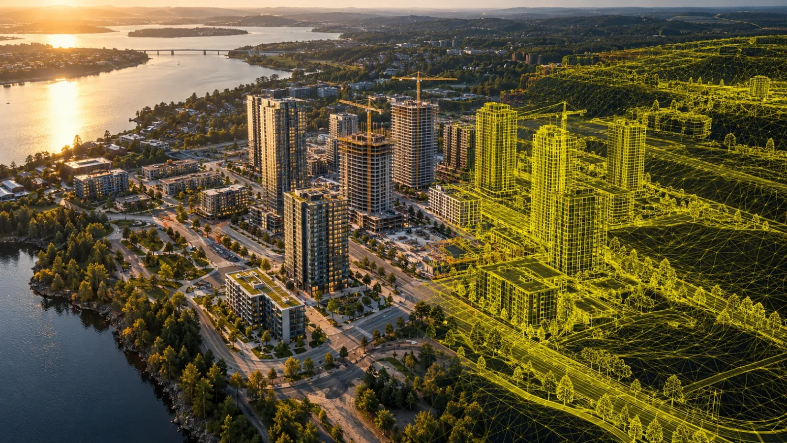
Executive Summary
- The Journey: YelloSKYE began with aerial drone technology, helping businesses capture, document, and understand their physical environments.
- The Evolution: Today, YelloSKYE is an AI-powered construction intelligence company, connecting multi-sensor reality capture, digital twins, engineering analytics, and project information through its DEX platform.
- The Vision: To make physical reality accessible, measurable, and actionable, enabling greater clarity, shared understanding, and decision confidence throughout the construction lifecycle.
From Drones to Deep Tech: A New Chapter in Construction Intelligence
Reality capture is where we started. Construction intelligence is what we're building.
Every construction project has a physical reality. It exists in the structures being built, the terrain being shaped, the materials being installed, and the thousands of activities moving a project forward. Understanding that reality is fundamental to effective project execution.
YelloSKYE began with a simple ambition: use aerial technology to help businesses see and understand their physical environments.
Drones gave us an extraordinary starting point. Through high-resolution aerial imagery, topographic mapping, and 3D site reconstruction, we helped project teams access accurate visual information about their sites.
As our work expanded across construction, real estate, and infrastructure, so did the possibilities. Captured imagery could become measurable terrain models. Repeated surveys could create historical progress records. Digital twins could connect physical site conditions with engineering designs. Construction analytics could turn these records into valuable operational intelligence.
What began with a better view of construction evolved into a much bigger ambition: building the intelligence infrastructure that connects physical reality with project decisions.
Today, YelloSKYE brings together multiple reality capture technologies, AI-assisted analytics, digital twins, and engineering expertise through one connected platform: DEX.
01. The Evolution: From Seeing Sites to Understanding Them
YelloSKYE's transformation into a deep-tech company has been shaped by four interconnected stages.
| Stage | Evolution | What It Enables |
|---|---|---|
| 01. Capture | Aerial intelligence | High-resolution visibility into physical site conditions |
| 02. Digitise | Multi-sensor reality capture | Structured digital representations of the built environment |
| 03. Interpret | AI and construction analytics | Engineering insights derived from captured site information |
| 04. Decide | DEX intelligence platform | Connected project information supporting better decisions |
Stage 1: Capture — Establishing Ground Truth
Our foundation was aerial technology. Drone-based surveys and imaging enabled project teams to access high-resolution site imagery, orthomosaic maps, and three-dimensional representations of physical environments. These capabilities brought a new level of visual clarity to land surveying, construction monitoring, and asset documentation.
Stage 2: Digitise — Expanding Beyond Drones
Different parts of a construction project benefit from different capture technologies. Our capabilities expanded to include 360° cameras, fixed cameras, laser scanning, and other spatial data sources, bringing together complementary perspectives of physical assets.
Aerial imagery provides site-wide context. Interior 360° capture allows teams to navigate enclosed spaces. Fixed cameras document activity over time. Laser scanning captures detailed structural geometry. Together, these technologies create a richer digital representation of the physical project.
Stage 3: Interpret — Turning Data into Intelligence
As the volume and variety of captured information grew, the next step was making that information more useful for construction teams. We expanded our capabilities in geospatial processing, digital twins, engineering analytics, and AI-assisted data interpretation.
Site information could now support workflows such as:
- Construction progress analysis: Comparing physical progress across reporting periods.
- Quantity and volumetric analysis: Measuring terrain, earthwork, and material volumes.
- Design verification: Comparing captured as-built conditions with relevant design information.
- Asset condition documentation: Reviewing high-resolution visual records of infrastructure and buildings.
- Project analytics: Organising progress information into dashboards and structured reports.
This marked an important progression: from capturing information about a project to helping teams understand what that information means.
Stage 4: Decide — Connecting Intelligence Through DEX
Through DEX, YelloSKYE's digital execution platform, project imagery, spatial data, analytics, and historical records become accessible to stakeholders across the construction lifecycle.
Engineers, project managers, developers, and leadership teams can work with a consistent reference of site reality.
One platform. Shared reality. More confident decisions.
The Big Idea: Reality capture tells you what exists. Construction intelligence helps you understand what it means. Connected intelligence helps you decide what comes next.
02. Under the Hood: The Technology Powering YelloSKYE
The evolution from a drone services company to a deep-tech construction intelligence company is built on an interconnected technology ecosystem. At YelloSKYE, the process connects four critical layers.
The YelloSKYE Construction Intelligence Stack
| Layer | Technology | Output |
|---|---|---|
| 01. Capture | Drones, 360° cameras, fixed cameras, laser scanning | Physical site data |
| 02. Process | Orthomosaic mapping, point clouds, terrain modelling, digital twins | Structured digital representations |
| 03. Interpret | Construction analytics, progress intelligence, quantity analysis, design comparison | Actionable project information |
| 04. Deliver | DEX dashboards, historical records, project reports | Connected project decisions |
Multi-Sensor Reality Capture
Each sensor contributes a different perspective of the built environment. By combining these perspectives, project teams can document sites, structures, interiors, and assets across multiple stages of development.
The result is a more complete representation of physical conditions that supports engineering, planning, execution, and asset management workflows.
Digital Twins and Spatial Processing
Captured imagery and measurements are processed into spatially organised digital information. Depending on the capture method and project requirements, these outputs include:
- Georeferenced orthomosaic maps
- Digital elevation and terrain models
- Three-dimensional point clouds
- Navigable interior visual records
- As-built documentation and BIM models
- Historical visual representations of construction progress
These outputs help teams connect physical site conditions with the technical information used to plan and execute projects.
Artificial Intelligence and Construction Analytics
YelloSKYE combines spatial datasets, engineering expertise, and AI-assisted analytics to support the interpretation of construction information.
This helps convert captured reality into structured insights for progress review, design coordination, quantity assessment, and project reporting.
The objective is straightforward: make project information easier to understand, verify, and act upon.
03. Five IQ Solutions. One Connected Intelligence Ecosystem.
Our evolution into construction intelligence extends across five specialised solution families, each addressing a distinct requirement within the built environment.
01. Survey IQ — Understand the Land Before You Build
Survey IQ transforms survey data into topographic maps, terrain models, contours, and volumetric information. Engineering and development teams use these outputs to assess site conditions, support land development planning, and review earthwork requirements.
Key applications: Topographic surveying, cut-and-fill analysis, terrain modelling, and design-stage planning.
02. Construct IQ — Turn Physical Progress into Project Intelligence
Construct IQ connects periodic reality capture with construction progress documentation and analytics. It helps project managers, PMOs, and leadership teams review execution, monitor milestones, and maintain consistent historical records.
Key applications: Construction progress monitoring, milestone reviews, site documentation, and project reporting.
03. BIM IQ — Connect Design Information with Built Reality
BIM IQ uses spatial capture and Scan-to-BIM workflows to develop as-built documentation and support engineering coordination. Project teams can reference captured physical geometry alongside design information throughout construction, renovation, and handover.
Key applications: Scan to BIM, as-built documentation, design comparison, and retrofit planning.
04. Inspect IQ — Understand Your Assets in Greater Detail
Inspect IQ supports high-resolution visual inspection and structured condition documentation for buildings, industrial assets, and infrastructure. These records help engineering and asset management teams review visible conditions and inform maintenance planning.
Key applications: Structural visual inspection, asset documentation, and condition assessment.
05. Studio IQ — Bring the Built Environment to Life
Studio IQ converts captured site imagery into aerial media, immersive walkthroughs, time-lapse videos, and presentation-ready visual experiences. These outputs help developers communicate their projects to customers, investors, and other stakeholders.
Key applications: Property marketing, visual documentation, interactive walkthroughs, and project storytelling.
Five IQs. One bigger purpose. Survey IQ understands the terrain. Construct IQ documents execution. BIM IQ connects design and reality. Inspect IQ supports asset assessment. Studio IQ communicates the built environment. DEX connects the intelligence.
04. Meet DEX: Where Ground Truth Becomes a Shared Reference
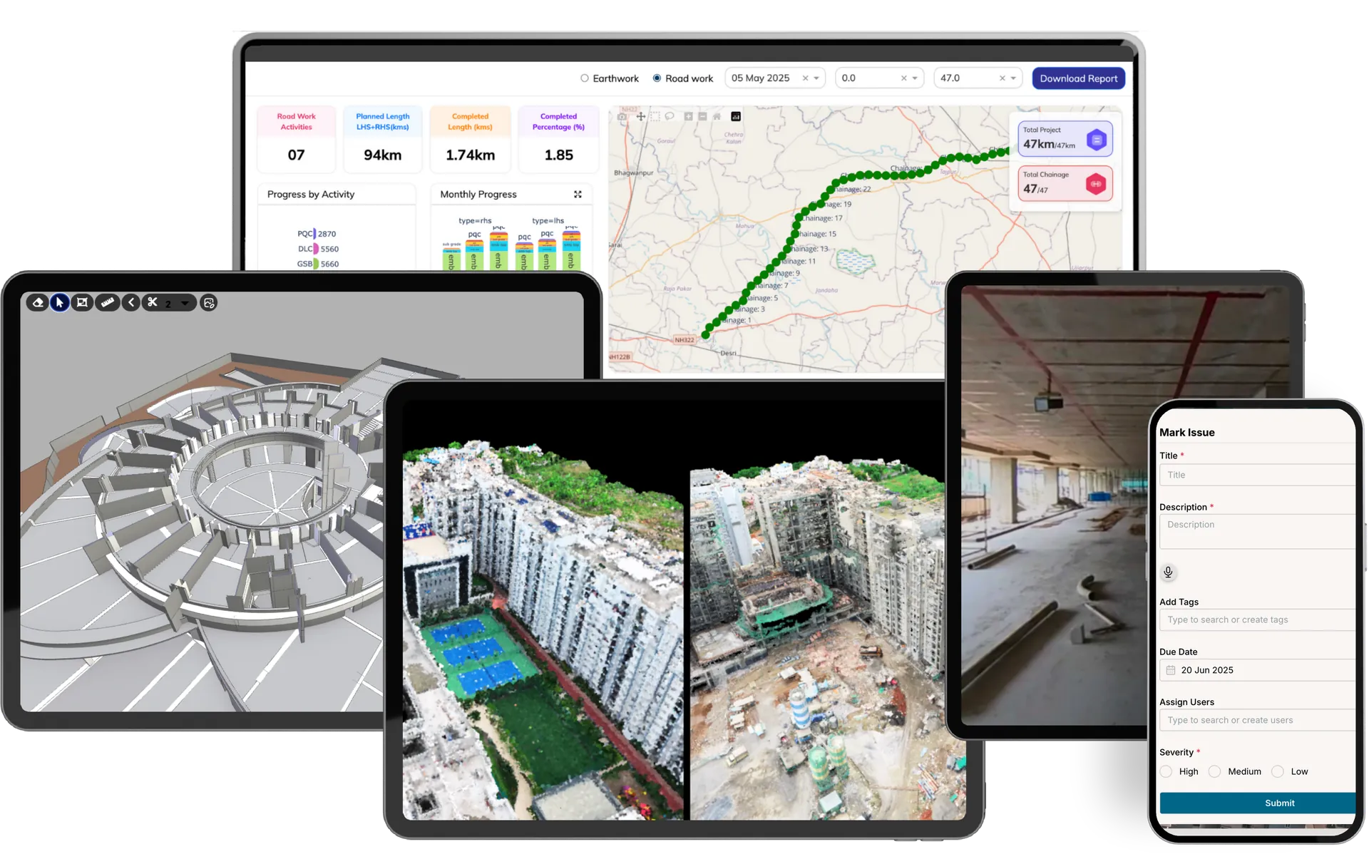
DEX brings together project visuals, spatial information, digital twins, and construction analytics in a shared digital environment.
At the centre of YelloSKYE's deep-tech evolution is DEX, our digital execution platform. DEX provides a connected environment for project imagery, spatial data, analytics, dashboards, and historical records.
Its purpose is to make relevant project information accessible to the people responsible for planning, executing, and managing construction.
How This Works Across a Real Project Lifecycle
Consider a developer managing a large industrial park.
During land acquisition and planning, engineering teams use drone-derived terrain information to understand site conditions, evaluate elevations, and support design decisions.
During construction, periodic aerial and interior captures create visual records of execution. Project teams review progress, quantities, and physical site conditions.
During management reviews, PMOs and leadership access documented project updates and relevant analytics through DEX.
During handover and operations, available visual records and as-built documentation provide context for asset management and future inspection activities.
Each stage creates information that can support subsequent decisions. DEX connects these records within a shared project environment.
What DEX Enables
| Capability | Value for Project Teams |
|---|---|
| Centralised project visibility | Access relevant site information across projects and locations |
| Historical project context | Review captured conditions and physical changes over time |
| Construction analytics | Connect spatial data with progress and engineering information |
| Digital twin access | Review spatially organised representations of physical environments |
| Stakeholder collaboration | Work from a shared reference across engineering, execution, and leadership |
Explore the DEX Construction Intelligence Platform →
05. What Deep Tech Means for Construction
Deep technology derives its value from the engineering, scientific, and computational capabilities behind the user experience.
For YelloSKYE, this means building technologies and workflows that combine:
- Geospatial Engineering: Mapping, measuring, and spatially referencing physical environments.
- Reality Capture and Photogrammetry: Converting sensor imagery into structured digital representations.
- Digital Twin Technology: Creating visual and measurable references of physical sites and assets.
- Construction Domain Intelligence: Connecting captured information with project planning, execution, and engineering requirements.
- Artificial Intelligence: Assisting with the processing, organisation, and interpretation of relevant project information.
- Cloud-Based Digital Platforms: Making project records, analytics, and spatial data available to distributed teams.
The value of these technologies becomes greater when they operate together. For the construction industry, this creates opportunities to connect what is happening physically on site with the information that guides engineering and business decisions.
06. What This Evolution Enables for Construction Leaders
The value of construction intelligence is ultimately measured by how effectively it supports the people delivering and managing complex projects.
For Developers and Asset Owners — Greater Clarity Across Portfolios
Access project conditions, progress records, and historical information through a shared digital environment. This supports management reviews, stakeholder communication, and portfolio-level decision-making.
For Project Directors and PMOs — A Stronger Reference for Execution
Connect visual progress records, project analytics, and physical site information to support milestone reviews, coordination, and reporting. Teams can review construction activity with better spatial and historical context.
For Engineering and Planning Teams — Physical Reality in Technical Context
Use terrain models, point clouds, as-built documentation, and other spatial datasets alongside engineering workflows. This supports planning, design review, quantity assessment, and construction coordination.
07. The Next Chapter: Building Decision Infrastructure for the Built Environment
YelloSKYE's journey began with the possibilities of aerial technology. That foundation has expanded into a broader mission: making physical reality accessible, measurable, and actionable throughout the lifecycle of the built environment.
Drones remain an important part of what we do. Today, they operate within a wider ecosystem of sensors, digital twins, construction analytics, and digital workflows.
The evolution reflects a progression from capturing site information to connecting that information with the decisions responsible for shaping physical projects.
Our focus continues to be grounded in four principles:
- Clarity: Making site reality understandable and dependable.
- Shared Reality: Giving stakeholders a consistent reference for project information.
- Intelligence: Turning captured information into meaningful context and insights.
- Decision Confidence: Helping teams make informed decisions supported by physical evidence.
Together, these principles shape YelloSKYE's evolution from a drone services company into a deep-tech construction intelligence company.
Your site, in sight. Your project intelligence, connected.
Explore the Next Generation of Construction Intelligence
See how YelloSKYE connects multi-sensor reality capture, digital twins, and construction analytics through DEX.
Whether you're managing a single construction project or a portfolio of assets, explore how a shared digital view of physical reality can support your teams.
Discuss Your Project with YelloSKYE →
Frequently asked questions
How does drone data become construction intelligence?
Drone imagery is processed into georeferenced maps, terrain models, point clouds and digital twins. Combined with project context and construction analytics, these outputs help teams review progress, quantities, site conditions and physical changes over time.
What makes YelloSKYE an AI-powered construction intelligence platform?
YelloSKYE connects multi-sensor reality capture, spatial processing, construction analytics and digital twin technology through DEX. Its five IQ solutions address land surveying, construction monitoring, asset inspection, Scan to BIM and visual documentation.
How do construction reality capture and digital twins work together?
Reality capture documents physical conditions through drones, 360-degree cameras, fixed cameras and laser scanning. The captured information can be processed into spatially referenced maps, point clouds and digital twins that support visual review, measurement and historical comparison.
How can developers and PMOs use construction intelligence?
Developers, PMOs and engineering teams use construction intelligence for site planning, progress monitoring, quantity analysis, design coordination, asset inspection and reporting. DEX provides a shared environment for relevant project imagery, analytics and historical records.